You are here: Home > Network List > AV - Alaska Volcano Observatory Stations List
> Station MAPS Pakushin Southeast, Makushin Volcano, Alaska > Earthquake Result Viewer
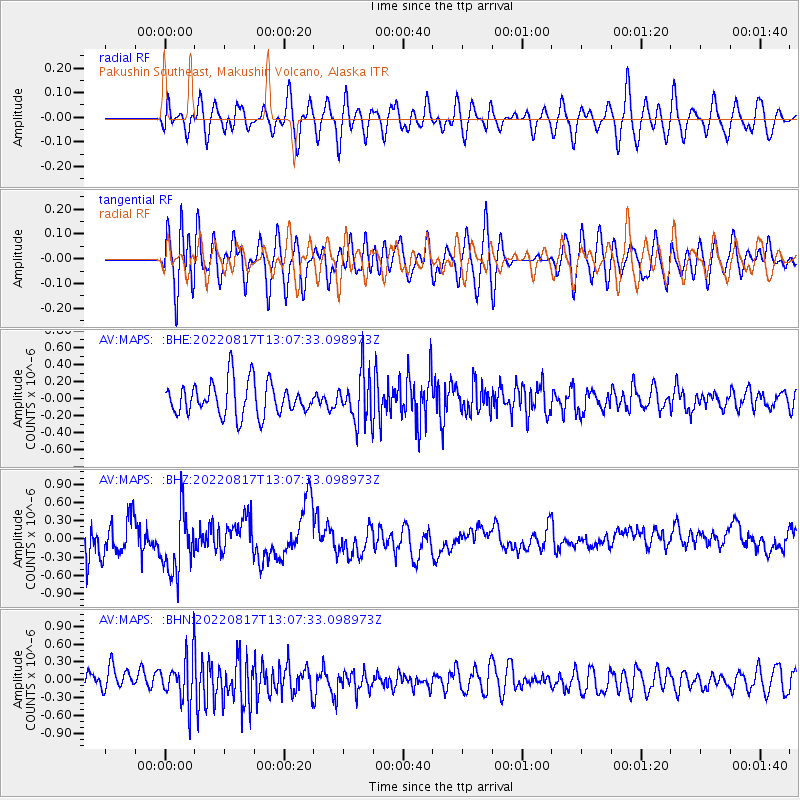
MAPS Pakushin Southeast, Makushin Volcano, Alaska - Earthquake Result Viewer
*The percent match for this event was below the threshold and hence no stack was calculated.
| Earthquake location: |
Banda Sea |
| Earthquake latitude/longitude: |
-7.0/125.5 |
| Earthquake time(UTC): |
2022/08/17 (229) 12:56:32 GMT |
| Earthquake Depth: |
488 km |
| Earthquake Magnitude: |
5.5 mww |
| Earthquake Catalog/Contributor: |
NEIC PDE/us |
|
| Network: |
AV Alaska Volcano Observatory |
| Station: |
MAPS Pakushin Southeast, Makushin Volcano, Alaska |
| Lat/Lon: |
53.81 N/166.94 W |
| Elevation: |
333 m |
|
| Distance: |
82.7 deg |
| Az: |
33.554 deg |
| Baz: |
247.684 deg |
| Ray Param: |
$rayparam |
*The percent match for this event was below the threshold and hence was not used in the summary stack. |
|
| Radial Match: |
49.75043 % |
| Radial Bump: |
400 |
| Transverse Match: |
52.76592 % |
| Transverse Bump: |
400 |
| SOD ConfigId: |
28764291 |
| Insert Time: |
2022-08-31 13:05:22.287 +0000 |
| GWidth: |
2.5 |
| Max Bumps: |
400 |
| Tol: |
0.001 |
|
Signal To Noise
| Channel | StoN | STA | LTA |
| AV:MAPS: :BHZ:20220817T13:07:33.098973Z | 1.6665328 | 5.4815536E-7 | 3.2891967E-7 |
| AV:MAPS: :BHN:20220817T13:07:33.098973Z | 2.474614 | 3.9372554E-7 | 1.5910585E-7 |
| AV:MAPS: :BHE:20220817T13:07:33.098973Z | 1.4753026 | 2.8873364E-7 | 1.9571148E-7 |
| Arrivals |
| Ps | |
| PpPs | |
| PsPs/PpSs | |


