NM36 NewMexico36 - Earthquake Result Viewer
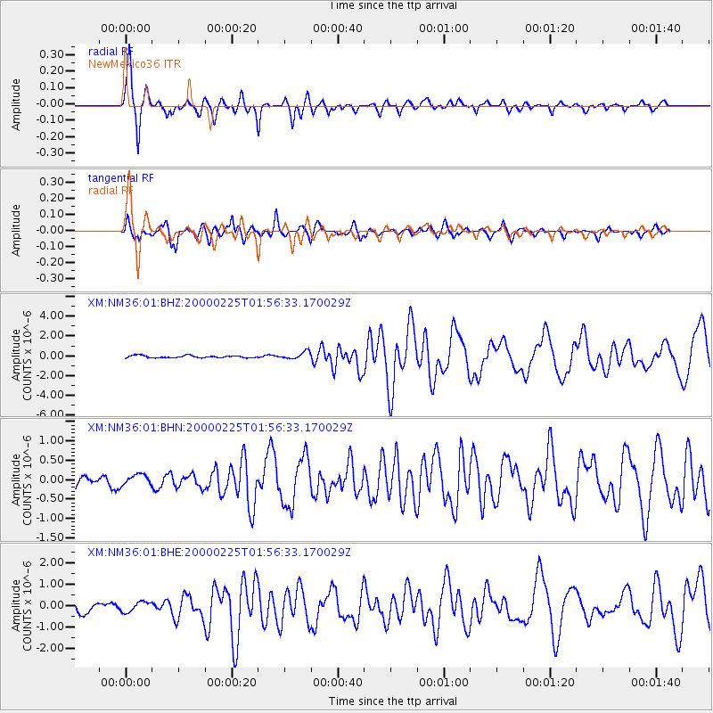
Earthquake location: Vanuatu Islands Region
Earthquake latitude/longitude: -19.5/173.8
Earthquake time(UTC): 2000/02/25 (056) 01:43:58 GMT
Earthquake Depth: 33 km
Earthquake Magnitude: 6.1 MB, 7.1 MS, 7.1 MW, 7.0 MW
Earthquake Catalog/Contributor: WHDF/NEIC
Network: XM Rio Grande Seismic Transect
Station: NM36 NewMexico36
Lat/Lon: 35.45 N/107.82 W
Elevation: 2176 m
Distance: 92.1 deg
Az: 53.153 deg
Baz: 247.578 deg
Ray Param: 0.041502662
Estimated Moho Depth: 40.75 km
Estimated Crust Vp/Vs: 2.03
Assumed Crust Vp: 6.502 km/s
Estimated Crust Vs: 3.211 km/s
Estimated Crust Poisson's Ratio: 0.34
Radial Match: 87.96677 %
Radial Bump: 400
Transverse Match: 79.5123 %
Transverse Bump: 400
SOD ConfigId: 3744
Insert Time: 2010-02-26 17:40:26.977 +0000
GWidth: 2.5
Max Bumps: 400
Tol: 0.001

Signal To Noise

ChannelStoNSTALTA
XM:NM36:01:BHN:20000225T01:56:33.170029Z0.82242781.2628567E-71.5355229E-7
XM:NM36:01:BHE:20000225T01:56:33.170029Z1.14959682.3681152E-72.0599528E-7
XM:NM36:01:BHZ:20000225T01:56:33.170029Z3.3378793.7293378E-71.1172777E-7
Arrivals
Ps6.5 SECOND
PpPs19 SECOND
PsPs/PpSs25 SECOND