NM36 NewMexico36 - Earthquake Result Viewer
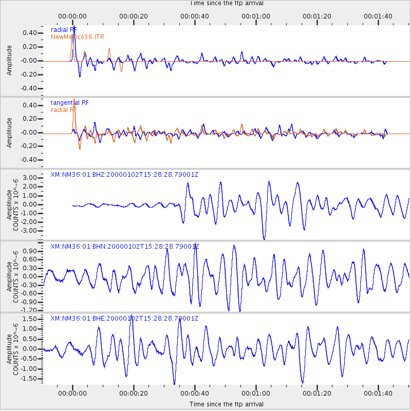
Earthquake location: Tonga Islands
Earthquake latitude/longitude: -20.8/-174.2
Earthquake time(UTC): 2000/01/02 (002) 15:16:32 GMT
Earthquake Depth: 33 km
Earthquake Magnitude: 5.5 MB, 5.8 MS, 5.8 MW, 5.8 MW
Earthquake Catalog/Contributor: WHDF/NEIC
Network: XM Rio Grande Seismic Transect
Station: NM36 NewMexico36
Lat/Lon: 35.45 N/107.82 W
Elevation: 2176 m
Distance: 84.1 deg
Az: 48.784 deg
Baz: 239.556 deg
Ray Param: 0.045653448
Estimated Moho Depth: 11.0 km
Estimated Crust Vp/Vs: 1.60
Assumed Crust Vp: 6.502 km/s
Estimated Crust Vs: 4.063 km/s
Estimated Crust Poisson's Ratio: 0.18
Radial Match: 91.85165 %
Radial Bump: 400
Transverse Match: 84.2577 %
Transverse Bump: 400
SOD ConfigId: 27569
Insert Time: 2010-02-26 17:40:30.681 +0000
GWidth: 2.5
Max Bumps: 400
Tol: 0.001

Signal To Noise

ChannelStoNSTALTA
XM:NM36:01:BHN:20000102T15:28:28.79001Z1.1892071.9545021E-71.643534E-7
XM:NM36:01:BHE:20000102T15:28:28.79001Z1.27509461.7873133E-71.4017103E-7
XM:NM36:01:BHZ:20000102T15:28:28.79001Z1.21756721.4884566E-71.2224841E-7
Arrivals
Ps1.0 SECOND
PpPs4.3 SECOND
PsPs/PpSs5.3 SECOND