NM36 NewMexico36 - Earthquake Result Viewer
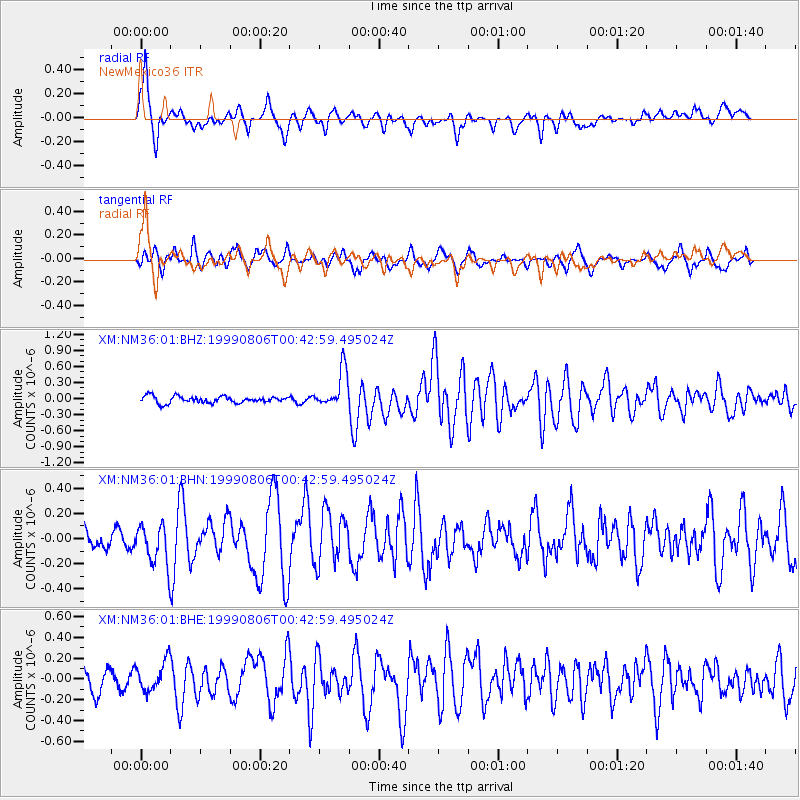
Earthquake location: Kuril Islands
Earthquake latitude/longitude: 49.9/156.3
Earthquake time(UTC): 1999/08/06 (218) 00:32:41 GMT
Earthquake Depth: 58 km
Earthquake Magnitude: 5.5 MB, 5.5 MS, 5.9 MW, 5.8 MW
Earthquake Catalog/Contributor: WHDF/NEIC
Network: XM Rio Grande Seismic Transect
Station: NM36 NewMexico36
Lat/Lon: 35.45 N/107.82 W
Elevation: 2176 m
Distance: 67.3 deg
Az: 61.699 deg
Baz: 315.826 deg
Ray Param: 0.056932833
Estimated Moho Depth: 56.0 km
Estimated Crust Vp/Vs: 1.60
Assumed Crust Vp: 6.502 km/s
Estimated Crust Vs: 4.063 km/s
Estimated Crust Poisson's Ratio: 0.18
Radial Match: 84.54609 %
Radial Bump: 378
Transverse Match: 71.334404 %
Transverse Bump: 400
SOD ConfigId: 27569
Insert Time: 2010-02-26 17:40:42.108 +0000
GWidth: 2.5
Max Bumps: 400
Tol: 0.001

Signal To Noise

ChannelStoNSTALTA
XM:NM36:01:BHN:19990806T00:42:59.495024Z2.10419441.595771E-77.583762E-8
XM:NM36:01:BHE:19990806T00:42:59.495024Z1.45211331.4068382E-79.688213E-8
XM:NM36:01:BHZ:19990806T00:42:59.495024Z5.71434263.5631237E-76.235405E-8
Arrivals
Ps5.4 SECOND
PpPs21 SECOND
PsPs/PpSs27 SECOND