You are here: Home > Network List > IU - Global Seismograph Network (GSN - IRIS/USGS) Stations List
> Station JOHN Johnston Island, USA > Earthquake Result Viewer
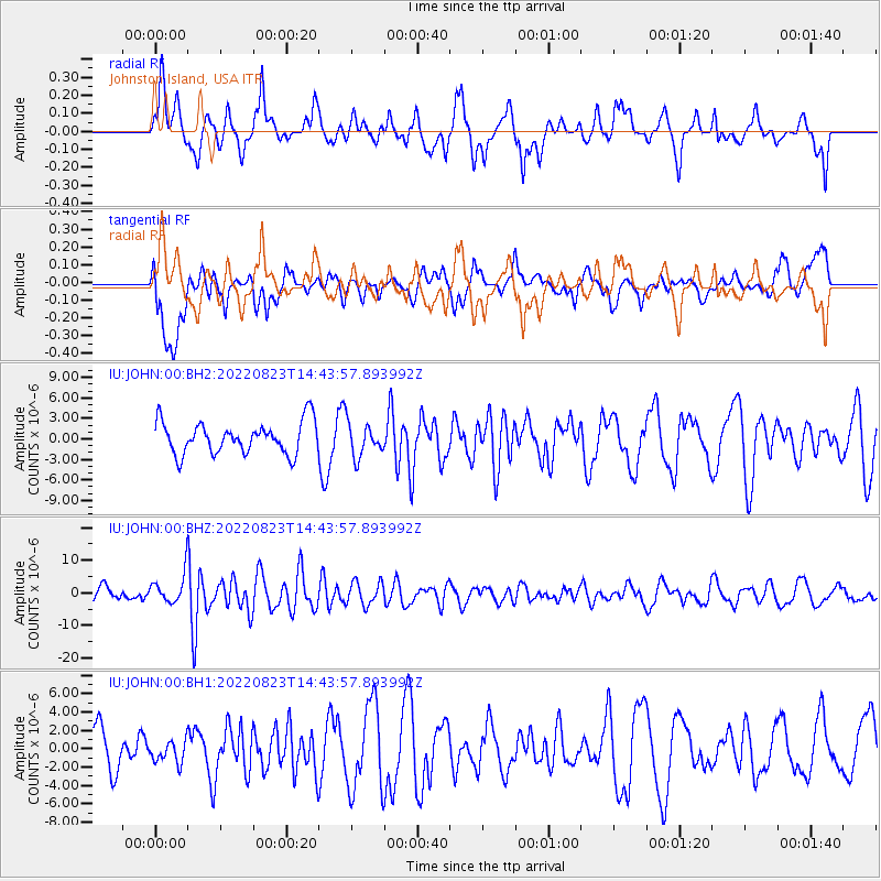
JOHN Johnston Island, USA - Earthquake Result Viewer
*The percent match for this event was below the threshold and hence no stack was calculated.
| Earthquake location: |
Southern Sumatra, Indonesia |
| Earthquake latitude/longitude: |
-5.1/103.1 |
| Earthquake time(UTC): |
2022/08/23 (235) 14:31:40 GMT |
| Earthquake Depth: |
59 km |
| Earthquake Magnitude: |
6.0 Mww |
| Earthquake Catalog/Contributor: |
NEIC PDE/us |
|
| Network: |
IU Global Seismograph Network (GSN - IRIS/USGS) |
| Station: |
JOHN Johnston Island, USA |
| Lat/Lon: |
16.73 N/169.53 W |
| Elevation: |
2.0 m |
|
| Distance: |
88.9 deg |
| Az: |
73.205 deg |
| Baz: |
264.416 deg |
| Ray Param: |
$rayparam |
*The percent match for this event was below the threshold and hence was not used in the summary stack. |
|
| Radial Match: |
67.13175 % |
| Radial Bump: |
400 |
| Transverse Match: |
70.298965 % |
| Transverse Bump: |
400 |
| SOD ConfigId: |
28764291 |
| Insert Time: |
2022-09-06 14:42:35.026 +0000 |
| GWidth: |
2.5 |
| Max Bumps: |
400 |
| Tol: |
0.001 |
|
Signal To Noise
| Channel | StoN | STA | LTA |
| IU:JOHN:00:BHZ:20220823T14:43:57.893992Z | 1.8557373 | 4.7749486E-6 | 2.5730735E-6 |
| IU:JOHN:00:BH1:20220823T14:43:57.893992Z | 0.42525852 | 1.1841012E-6 | 2.7844267E-6 |
| IU:JOHN:00:BH2:20220823T14:43:57.893992Z | 1.0488653 | 2.427856E-6 | 2.3147452E-6 |
| Arrivals |
| Ps | |
| PpPs | |
| PsPs/PpSs | |


