You are here: Home > Network List > IW - Intermountain West Stations List
> Station MOOW Moose Ponds, Wyoming, USA > Earthquake Result Viewer
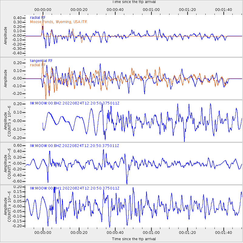
MOOW Moose Ponds, Wyoming, USA - Earthquake Result Viewer
*The percent match for this event was below the threshold and hence no stack was calculated.
| Earthquake location: |
Chile-Bolivia Border Region |
| Earthquake latitude/longitude: |
-22.0/-68.5 |
| Earthquake time(UTC): |
2022/08/24 (236) 12:09:45 GMT |
| Earthquake Depth: |
108 km |
| Earthquake Magnitude: |
5.4 Mww |
| Earthquake Catalog/Contributor: |
NEIC PDE/us |
|
| Network: |
IW Intermountain West |
| Station: |
MOOW Moose Ponds, Wyoming, USA |
| Lat/Lon: |
43.75 N/110.74 W |
| Elevation: |
2128 m |
|
| Distance: |
76.0 deg |
| Az: |
329.862 deg |
| Baz: |
139.98 deg |
| Ray Param: |
$rayparam |
*The percent match for this event was below the threshold and hence was not used in the summary stack. |
|
| Radial Match: |
69.39221 % |
| Radial Bump: |
400 |
| Transverse Match: |
52.25221 % |
| Transverse Bump: |
400 |
| SOD ConfigId: |
28764291 |
| Insert Time: |
2022-09-07 12:24:43.936 +0000 |
| GWidth: |
2.5 |
| Max Bumps: |
400 |
| Tol: |
0.001 |
|
Signal To Noise
| Channel | StoN | STA | LTA |
| IW:MOOW:00:BHZ:20220824T12:20:50.375011Z | 3.1964478 | 2.056703E-7 | 6.4343396E-8 |
| IW:MOOW:00:BH1:20220824T12:20:50.375011Z | 1.7378258 | 7.7919765E-8 | 4.4837503E-8 |
| IW:MOOW:00:BH2:20220824T12:20:50.375011Z | 2.1086764 | 1.2964419E-7 | 6.1481316E-8 |
| Arrivals |
| Ps | |
| PpPs | |
| PsPs/PpSs | |


