You are here: Home > Network List > US - United States National Seismic Network Stations List
> Station HAWA Hanford, Washington, USA > Earthquake Result Viewer
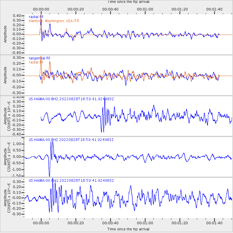
HAWA Hanford, Washington, USA - Earthquake Result Viewer
*The percent match for this event was below the threshold and hence no stack was calculated.
| Earthquake location: |
Fiji Islands Region |
| Earthquake latitude/longitude: |
-21.8/-176.8 |
| Earthquake time(UTC): |
2022/08/28 (240) 18:48:01 GMT |
| Earthquake Depth: |
221 km |
| Earthquake Magnitude: |
5.6 mww |
| Earthquake Catalog/Contributor: |
NEIC PDE/us |
|
| Network: |
US United States National Seismic Network |
| Station: |
HAWA Hanford, Washington, USA |
| Lat/Lon: |
46.39 N/119.53 W |
| Elevation: |
364 m |
|
| Distance: |
85.3 deg |
| Az: |
35.738 deg |
| Baz: |
231.639 deg |
| Ray Param: |
$rayparam |
*The percent match for this event was below the threshold and hence was not used in the summary stack. |
|
| Radial Match: |
73.67049 % |
| Radial Bump: |
400 |
| Transverse Match: |
59.782562 % |
| Transverse Bump: |
400 |
| SOD ConfigId: |
28764291 |
| Insert Time: |
2022-09-11 19:11:16.953 +0000 |
| GWidth: |
2.5 |
| Max Bumps: |
400 |
| Tol: |
0.001 |
|
Signal To Noise
| Channel | StoN | STA | LTA |
| US:HAWA:00:BHZ:20220828T18:59:41.924983Z | 5.4796567 | 3.849243E-7 | 7.024607E-8 |
| US:HAWA:00:BH1:20220828T18:59:41.924983Z | 1.5610852 | 7.165326E-8 | 4.5899647E-8 |
| US:HAWA:00:BH2:20220828T18:59:41.924983Z | 1.1623485 | 7.7788684E-8 | 6.692372E-8 |
| Arrivals |
| Ps | |
| PpPs | |
| PsPs/PpSs | |


