You are here: Home > Network List > CN - Canadian National Seismograph Network Stations List
> Station INK INUVIK, NT > Earthquake Result Viewer
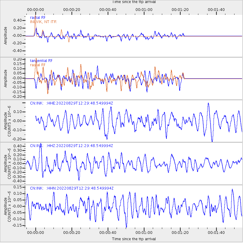
INK INUVIK, NT - Earthquake Result Viewer
*The percent match for this event was below the threshold and hence no stack was calculated.
| Earthquake location: |
Ryukyu Islands, Japan |
| Earthquake latitude/longitude: |
28.9/130.7 |
| Earthquake time(UTC): |
2022/08/29 (241) 12:19:35 GMT |
| Earthquake Depth: |
10 km |
| Earthquake Magnitude: |
5.6 Mww |
| Earthquake Catalog/Contributor: |
NEIC PDE/us |
|
| Network: |
CN Canadian National Seismograph Network |
| Station: |
INK INUVIK, NT |
| Lat/Lon: |
68.31 N/133.53 W |
| Elevation: |
44 m |
|
| Distance: |
65.6 deg |
| Az: |
23.962 deg |
| Baz: |
286.648 deg |
| Ray Param: |
$rayparam |
*The percent match for this event was below the threshold and hence was not used in the summary stack. |
|
| Radial Match: |
64.09002 % |
| Radial Bump: |
400 |
| Transverse Match: |
64.78926 % |
| Transverse Bump: |
400 |
| SOD ConfigId: |
28764291 |
| Insert Time: |
2022-09-12 12:38:33.036 +0000 |
| GWidth: |
2.5 |
| Max Bumps: |
400 |
| Tol: |
0.001 |
|
Signal To Noise
| Channel | StoN | STA | LTA |
| CN:INK: :HHZ:20220829T12:29:48.549994Z | 3.6415927 | 2.2571716E-7 | 6.198309E-8 |
| CN:INK: :HHN:20220829T12:29:48.549994Z | 0.4573951 | 1.8672463E-8 | 4.0823487E-8 |
| CN:INK: :HHE:20220829T12:29:48.549994Z | 0.8131239 | 4.5948852E-8 | 5.6509045E-8 |
| Arrivals |
| Ps | |
| PpPs | |
| PsPs/PpSs | |


