You are here: Home > Network List > AV - Alaska Volcano Observatory Stations List
> Station PLBL Mt. Peulik Volcano, Alaska > Earthquake Result Viewer
PLBL Mt. Peulik Volcano, Alaska - Earthquake Result Viewer
*The percent match for this event was below the threshold and hence no stack was calculated.
| Earthquake location: |
South Of Kermadec Islands |
| Earthquake latitude/longitude: |
-32.7/-179.1 |
| Earthquake time(UTC): |
2022/08/29 (241) 18:10:50 GMT |
| Earthquake Depth: |
32 km |
| Earthquake Magnitude: |
5.8 mww |
| Earthquake Catalog/Contributor: |
NEIC PDE/us |
|
| Network: |
AV Alaska Volcano Observatory |
| Station: |
PLBL Mt. Peulik Volcano, Alaska |
| Lat/Lon: |
57.70 N/156.82 W |
| Elevation: |
461 m |
|
| Distance: |
92.0 deg |
| Az: |
11.73 deg |
| Baz: |
198.61 deg |
| Ray Param: |
$rayparam |
*The percent match for this event was below the threshold and hence was not used in the summary stack. |
|
| Radial Match: |
47.175262 % |
| Radial Bump: |
400 |
| Transverse Match: |
52.019276 % |
| Transverse Bump: |
400 |
| SOD ConfigId: |
28764291 |
| Insert Time: |
2022-09-12 18:18:04.443 +0000 |
| GWidth: |
2.5 |
| Max Bumps: |
400 |
| Tol: |
0.001 |
|
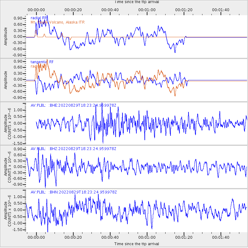
Signal To Noise
| Channel | StoN | STA | LTA |
| AV:PLBL: :BHZ:20220829T18:23:24.959978Z | 2.6921916 | 4.4897587E-7 | 1.6676965E-7 |
| AV:PLBL: :BHN:20220829T18:23:24.959978Z | 1.4488038 | 6.903202E-7 | 4.7647595E-7 |
| AV:PLBL: :BHE:20220829T18:23:24.959978Z | 2.4785793 | 6.812452E-7 | 2.748531E-7 |
| Arrivals |
| Ps | |
| PpPs | |
| PsPs/PpSs | |


