You are here: Home > Network List > IU - Global Seismograph Network (GSN - IRIS/USGS) Stations List
> Station CTAO Charters Towers, Australia > Earthquake Result Viewer
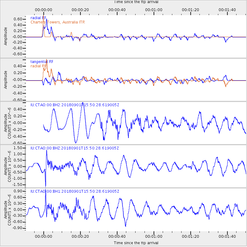
CTAO Charters Towers, Australia - Earthquake Result Viewer
*The percent match for this event was below the threshold and hence no stack was calculated.
| Earthquake location: |
Bonin Islands, Japan Region |
| Earthquake latitude/longitude: |
27.9/139.9 |
| Earthquake time(UTC): |
2018/09/01 (244) 15:43:02 GMT |
| Earthquake Depth: |
455 km |
| Earthquake Magnitude: |
5.6 Mww |
| Earthquake Catalog/Contributor: |
NEIC PDE/us |
|
| Network: |
IU Global Seismograph Network (GSN - IRIS/USGS) |
| Station: |
CTAO Charters Towers, Australia |
| Lat/Lon: |
20.09 S/146.25 E |
| Elevation: |
357 m |
|
| Distance: |
48.1 deg |
| Az: |
172.023 deg |
| Baz: |
352.493 deg |
| Ray Param: |
$rayparam |
*The percent match for this event was below the threshold and hence was not used in the summary stack. |
|
| Radial Match: |
75.57324 % |
| Radial Bump: |
400 |
| Transverse Match: |
46.175797 % |
| Transverse Bump: |
400 |
| SOD ConfigId: |
2825771 |
| Insert Time: |
2018-09-15 15:48:07.920 +0000 |
| GWidth: |
2.5 |
| Max Bumps: |
400 |
| Tol: |
0.001 |
|
Signal To Noise
| Channel | StoN | STA | LTA |
| IU:CTAO:00:BHZ:20180901T15:50:28.619005Z | 2.6060543 | 5.8550773E-7 | 2.246721E-7 |
| IU:CTAO:00:BH1:20180901T15:50:28.619005Z | 3.2760835 | 2.8977718E-7 | 8.845232E-8 |
| IU:CTAO:00:BH2:20180901T15:50:28.619005Z | 0.8700452 | 2.6383773E-7 | 3.03246E-7 |
| Arrivals |
| Ps | |
| PpPs | |
| PsPs/PpSs | |


