You are here: Home > Network List > US - United States National Seismic Network Stations List
> Station HAWA Hanford, Washington, USA > Earthquake Result Viewer
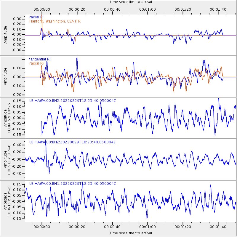
HAWA Hanford, Washington, USA - Earthquake Result Viewer
*The percent match for this event was below the threshold and hence no stack was calculated.
| Earthquake location: |
South Of Kermadec Islands |
| Earthquake latitude/longitude: |
-32.7/-179.1 |
| Earthquake time(UTC): |
2022/08/29 (241) 18:10:50 GMT |
| Earthquake Depth: |
32 km |
| Earthquake Magnitude: |
5.8 mww |
| Earthquake Catalog/Contributor: |
NEIC PDE/us |
|
| Network: |
US United States National Seismic Network |
| Station: |
HAWA Hanford, Washington, USA |
| Lat/Lon: |
46.39 N/119.53 W |
| Elevation: |
364 m |
|
| Distance: |
95.3 deg |
| Az: |
36.804 deg |
| Baz: |
226.848 deg |
| Ray Param: |
$rayparam |
*The percent match for this event was below the threshold and hence was not used in the summary stack. |
|
| Radial Match: |
54.68823 % |
| Radial Bump: |
400 |
| Transverse Match: |
65.8972 % |
| Transverse Bump: |
400 |
| SOD ConfigId: |
28764291 |
| Insert Time: |
2022-09-12 18:28:52.959 +0000 |
| GWidth: |
2.5 |
| Max Bumps: |
400 |
| Tol: |
0.001 |
|
Signal To Noise
| Channel | StoN | STA | LTA |
| US:HAWA:00:BHZ:20220829T18:23:40.050004Z | 2.6523395 | 1.961157E-7 | 7.3940654E-8 |
| US:HAWA:00:BH1:20220829T18:23:40.050004Z | 0.92439455 | 5.8155848E-8 | 6.291236E-8 |
| US:HAWA:00:BH2:20220829T18:23:40.050004Z | 1.0843891 | 6.6632445E-8 | 6.144699E-8 |
| Arrivals |
| Ps | |
| PpPs | |
| PsPs/PpSs | |


