You are here: Home > Network List > IU - Global Seismograph Network (GSN - IRIS/USGS) Stations List
> Station RSSD Black Hills, South Dakota, USA > Earthquake Result Viewer
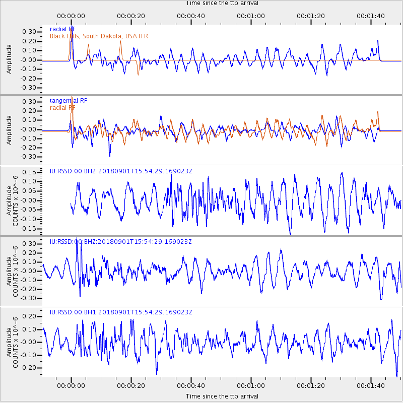
RSSD Black Hills, South Dakota, USA - Earthquake Result Viewer
*The percent match for this event was below the threshold and hence no stack was calculated.
| Earthquake location: |
Bonin Islands, Japan Region |
| Earthquake latitude/longitude: |
27.9/139.9 |
| Earthquake time(UTC): |
2018/09/01 (244) 15:43:02 GMT |
| Earthquake Depth: |
455 km |
| Earthquake Magnitude: |
5.6 Mww |
| Earthquake Catalog/Contributor: |
NEIC PDE/us |
|
| Network: |
IU Global Seismograph Network (GSN - IRIS/USGS) |
| Station: |
RSSD Black Hills, South Dakota, USA |
| Lat/Lon: |
44.12 N/104.04 W |
| Elevation: |
2090 m |
|
| Distance: |
87.5 deg |
| Az: |
40.377 deg |
| Baz: |
307.257 deg |
| Ray Param: |
$rayparam |
*The percent match for this event was below the threshold and hence was not used in the summary stack. |
|
| Radial Match: |
60.800846 % |
| Radial Bump: |
400 |
| Transverse Match: |
55.004227 % |
| Transverse Bump: |
400 |
| SOD ConfigId: |
2825771 |
| Insert Time: |
2018-09-15 15:48:27.585 +0000 |
| GWidth: |
2.5 |
| Max Bumps: |
400 |
| Tol: |
0.001 |
|
Signal To Noise
| Channel | StoN | STA | LTA |
| IU:RSSD:00:BHZ:20180901T15:54:29.169023Z | 1.9504358 | 1.4531824E-7 | 7.450552E-8 |
| IU:RSSD:00:BH1:20180901T15:54:29.169023Z | 1.4910896 | 7.898163E-8 | 5.2969074E-8 |
| IU:RSSD:00:BH2:20180901T15:54:29.169023Z | 1.2427881 | 6.443182E-8 | 5.184458E-8 |
| Arrivals |
| Ps | |
| PpPs | |
| PsPs/PpSs | |


