You are here: Home > Network List > IW - Intermountain West Stations List
> Station DLMT Dillon, Montana, USA > Earthquake Result Viewer
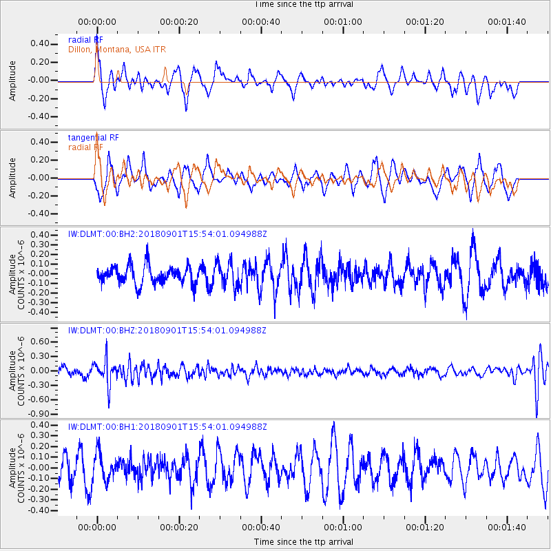
DLMT Dillon, Montana, USA - Earthquake Result Viewer
*The percent match for this event was below the threshold and hence no stack was calculated.
| Earthquake location: |
Bonin Islands, Japan Region |
| Earthquake latitude/longitude: |
27.9/139.9 |
| Earthquake time(UTC): |
2018/09/01 (244) 15:43:02 GMT |
| Earthquake Depth: |
455 km |
| Earthquake Magnitude: |
5.6 Mww |
| Earthquake Catalog/Contributor: |
NEIC PDE/us |
|
| Network: |
IW Intermountain West |
| Station: |
DLMT Dillon, Montana, USA |
| Lat/Lon: |
45.36 N/112.60 W |
| Elevation: |
1569 m |
|
| Distance: |
81.8 deg |
| Az: |
42.807 deg |
| Baz: |
301.473 deg |
| Ray Param: |
$rayparam |
*The percent match for this event was below the threshold and hence was not used in the summary stack. |
|
| Radial Match: |
50.3582 % |
| Radial Bump: |
400 |
| Transverse Match: |
51.59764 % |
| Transverse Bump: |
400 |
| SOD ConfigId: |
2825771 |
| Insert Time: |
2018-09-15 15:48:42.557 +0000 |
| GWidth: |
2.5 |
| Max Bumps: |
400 |
| Tol: |
0.001 |
|
Signal To Noise
| Channel | StoN | STA | LTA |
| IW:DLMT:00:BHZ:20180901T15:54:01.094988Z | 3.1215036 | 2.6424252E-7 | 8.465232E-8 |
| IW:DLMT:00:BH1:20180901T15:54:01.094988Z | 1.4638884 | 1.3044037E-7 | 8.910541E-8 |
| IW:DLMT:00:BH2:20180901T15:54:01.094988Z | 1.3542908 | 1.254921E-7 | 9.266258E-8 |
| Arrivals |
| Ps | |
| PpPs | |
| PsPs/PpSs | |


