You are here: Home > Network List > US - United States National Seismic Network Stations List
> Station HAWA Hanford, Washington, USA > Earthquake Result Viewer
HAWA Hanford, Washington, USA - Earthquake Result Viewer
*The percent match for this event was below the threshold and hence no stack was calculated.
| Earthquake location: |
Bonin Islands, Japan Region |
| Earthquake latitude/longitude: |
27.9/139.9 |
| Earthquake time(UTC): |
2018/09/01 (244) 15:43:02 GMT |
| Earthquake Depth: |
455 km |
| Earthquake Magnitude: |
5.6 Mww |
| Earthquake Catalog/Contributor: |
NEIC PDE/us |
|
| Network: |
US United States National Seismic Network |
| Station: |
HAWA Hanford, Washington, USA |
| Lat/Lon: |
46.39 N/119.53 W |
| Elevation: |
364 m |
|
| Distance: |
77.0 deg |
| Az: |
44.291 deg |
| Baz: |
296.78 deg |
| Ray Param: |
$rayparam |
*The percent match for this event was below the threshold and hence was not used in the summary stack. |
|
| Radial Match: |
56.0191 % |
| Radial Bump: |
400 |
| Transverse Match: |
59.22127 % |
| Transverse Bump: |
400 |
| SOD ConfigId: |
2825771 |
| Insert Time: |
2018-09-15 15:50:57.756 +0000 |
| GWidth: |
2.5 |
| Max Bumps: |
400 |
| Tol: |
0.001 |
|
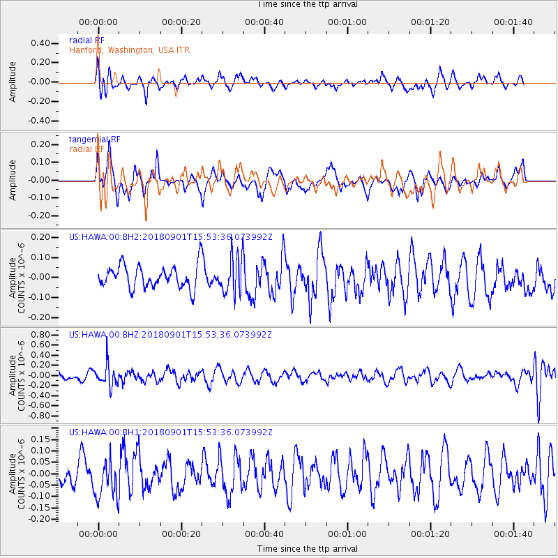
Signal To Noise
| Channel | StoN | STA | LTA |
| US:HAWA:00:BHZ:20180901T15:53:36.073992Z | 2.6744046 | 2.1607487E-7 | 8.079363E-8 |
| US:HAWA:00:BH1:20180901T15:53:36.073992Z | 1.1629184 | 8.587765E-8 | 7.3846664E-8 |
| US:HAWA:00:BH2:20180901T15:53:36.073992Z | 1.6995523 | 9.602457E-8 | 5.649992E-8 |
| Arrivals |
| Ps | |
| PpPs | |
| PsPs/PpSs | |


