You are here: Home > Network List > II - Global Seismograph Network (GSN - IRIS/IDA) Stations List
> Station MBAR Mbarara, Uganda > Earthquake Result Viewer
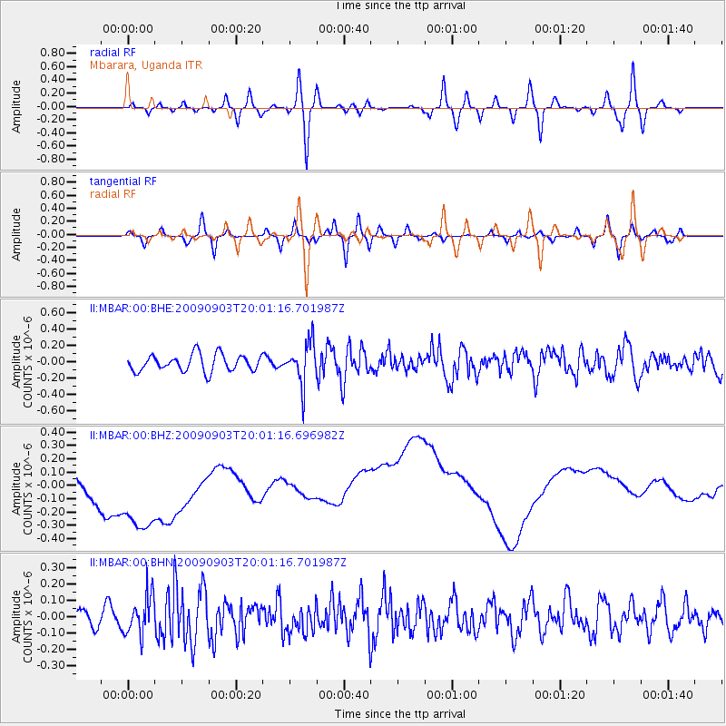
MBAR Mbarara, Uganda - Earthquake Result Viewer
*The percent match for this event was below the threshold and hence no stack was calculated.
| Earthquake location: |
Myanmar-India Border Region |
| Earthquake latitude/longitude: |
24.3/94.7 |
| Earthquake time(UTC): |
2009/09/03 (246) 19:51:08 GMT |
| Earthquake Depth: |
105 km |
| Earthquake Magnitude: |
5.7 MB, 5.9 MW, 5.8 MW |
| Earthquake Catalog/Contributor: |
WHDF/NEIC |
|
| Network: |
II Global Seismograph Network (GSN - IRIS/IDA) |
| Station: |
MBAR Mbarara, Uganda |
| Lat/Lon: |
0.60 S/30.74 E |
| Elevation: |
1390 m |
|
| Distance: |
66.6 deg |
| Az: |
258.091 deg |
| Baz: |
63.207 deg |
| Ray Param: |
$rayparam |
*The percent match for this event was below the threshold and hence was not used in the summary stack. |
|
| Radial Match: |
47.21952 % |
| Radial Bump: |
400 |
| Transverse Match: |
50.720604 % |
| Transverse Bump: |
400 |
| SOD ConfigId: |
1 |
| Insert Time: |
2010-02-19 00:08:06.224 +0000 |
| GWidth: |
2.5 |
| Max Bumps: |
400 |
| Tol: |
0.001 |
|
Signal To Noise
| Channel | StoN | STA | LTA |
| II:MBAR:00:BHZ:20090903T20:01:16.696982Z | 2.7740388 | 5.0403315E-7 | 1.8169649E-7 |
| II:MBAR:00:BHN:20090903T20:01:16.701987Z | 1.9530208 | 1.2325684E-7 | 6.3110875E-8 |
| II:MBAR:00:BHE:20090903T20:01:16.701987Z | 2.48336 | 2.529756E-7 | 1.0186828E-7 |
| Arrivals |
| Ps | |
| PpPs | |
| PsPs/PpSs | |


