SENIN CH.SENIN - Earthquake Result Viewer
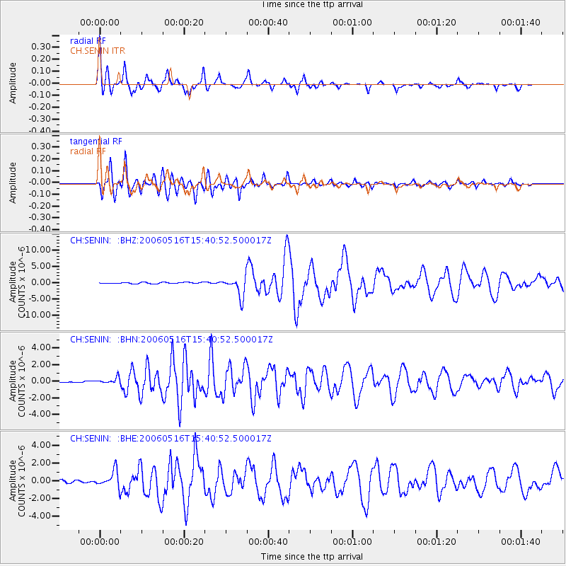
Earthquake location: Northern Sumatra, Indonesia
Earthquake latitude/longitude: 0.1/97.1
Earthquake time(UTC): 2006/05/16 (136) 15:28:25 GMT
Earthquake Depth: 12 km
Earthquake Magnitude: 6.6 MB, 6.8 MS, 6.8 MW, 6.8 MW
Earthquake Catalog/Contributor: WHDF/NEIC
Network: CH Switzerland Seismological Network
Station: SENIN CH.SENIN
Lat/Lon: 46.36 N/7.30 E
Elevation: 2082 m
Distance: 89.8 deg
Az: 316.171 deg
Baz: 90.116 deg
Ray Param: 0.04172136
Estimated Moho Depth: 13.5 km
Estimated Crust Vp/Vs: 1.82
Assumed Crust Vp: 6.276 km/s
Estimated Crust Vs: 3.458 km/s
Estimated Crust Poisson's Ratio: 0.28
Radial Match: 93.197235 %
Radial Bump: 400
Transverse Match: 94.81523 %
Transverse Bump: 400
SOD ConfigId: 2669
Insert Time: 2010-02-25 19:22:44.436 +0000
GWidth: 2.5
Max Bumps: 400
Tol: 0.001

Signal To Noise

ChannelStoNSTALTA
CH:SENIN: :BHN:20060516T15:40:52.500017Z5.12988473.7827053E-77.3738605E-8
CH:SENIN: :BHE:20060516T15:40:52.500017Z8.3666959.782642E-71.16923616E-7
CH:SENIN: :BHZ:20060516T15:40:52.500017Z15.9844373.1946406E-61.9985943E-7
Arrivals
Ps1.8 SECOND
PpPs5.9 SECOND
PsPs/PpSs7.7 SECOND