You are here: Home > Network List > US - United States National Seismic Network Stations List
> Station DGMT Dagmar, Montana, USA > Earthquake Result Viewer
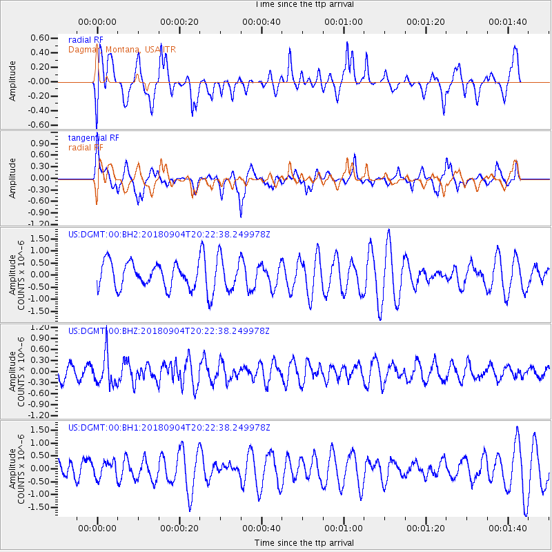
DGMT Dagmar, Montana, USA - Earthquake Result Viewer
*The percent match for this event was below the threshold and hence no stack was calculated.
| Earthquake location: |
Near East Coast Of Honshu, Japan |
| Earthquake latitude/longitude: |
36.4/141.5 |
| Earthquake time(UTC): |
2018/09/04 (247) 20:11:19 GMT |
| Earthquake Depth: |
39 km |
| Earthquake Magnitude: |
5.4 Mww |
| Earthquake Catalog/Contributor: |
NEIC PDE/us |
|
| Network: |
US United States National Seismic Network |
| Station: |
DGMT Dagmar, Montana, USA |
| Lat/Lon: |
48.47 N/104.20 W |
| Elevation: |
0.0 m |
|
| Distance: |
77.2 deg |
| Az: |
38.468 deg |
| Baz: |
311.088 deg |
| Ray Param: |
$rayparam |
*The percent match for this event was below the threshold and hence was not used in the summary stack. |
|
| Radial Match: |
47.992176 % |
| Radial Bump: |
400 |
| Transverse Match: |
60.493656 % |
| Transverse Bump: |
400 |
| SOD ConfigId: |
2825771 |
| Insert Time: |
2018-09-18 20:41:18.493 +0000 |
| GWidth: |
2.5 |
| Max Bumps: |
400 |
| Tol: |
0.001 |
|
Signal To Noise
| Channel | StoN | STA | LTA |
| US:DGMT:00:BHZ:20180904T20:22:38.249978Z | 1.4525896 | 4.3158218E-7 | 2.9711225E-7 |
| US:DGMT:00:BH1:20180904T20:22:38.249978Z | 0.59827155 | 3.257742E-7 | 5.445257E-7 |
| US:DGMT:00:BH2:20180904T20:22:38.249978Z | 1.3542744 | 6.66054E-7 | 4.9181614E-7 |
| Arrivals |
| Ps | |
| PpPs | |
| PsPs/PpSs | |


