You are here: Home > Network List > IU - Global Seismograph Network (GSN - IRIS/USGS) Stations List
> Station SLBS Sierra la Laguna Baja California Sur, Mexico > Earthquake Result Viewer
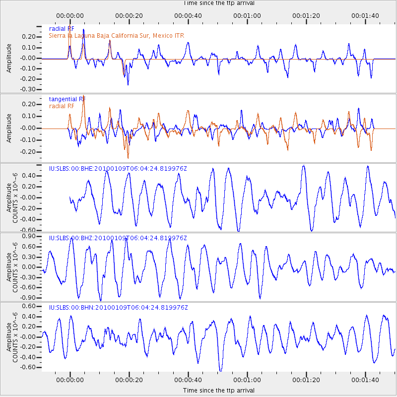
SLBS Sierra la Laguna Baja California Sur, Mexico - Earthquake Result Viewer
*The percent match for this event was below the threshold and hence no stack was calculated.
| Earthquake location: |
Solomon Islands |
| Earthquake latitude/longitude: |
-9.1/157.6 |
| Earthquake time(UTC): |
2010/01/09 (009) 05:51:30 GMT |
| Earthquake Depth: |
12 km |
| Earthquake Magnitude: |
6.0 MB, 6.2 MS, 6.2 MW, 6.2 MW |
| Earthquake Catalog/Contributor: |
WHDF/NEIC |
|
| Network: |
IU Global Seismograph Network (GSN - IRIS/USGS) |
| Station: |
SLBS Sierra la Laguna Baja California Sur, Mexico |
| Lat/Lon: |
23.69 N/109.94 W |
| Elevation: |
825 m |
|
| Distance: |
95.8 deg |
| Az: |
67.024 deg |
| Baz: |
262.619 deg |
| Ray Param: |
$rayparam |
*The percent match for this event was below the threshold and hence was not used in the summary stack. |
|
| Radial Match: |
57.198914 % |
| Radial Bump: |
349 |
| Transverse Match: |
55.880955 % |
| Transverse Bump: |
400 |
| SOD ConfigId: |
1 |
| Insert Time: |
2010-03-17 20:59:08.971 +0000 |
| GWidth: |
2.5 |
| Max Bumps: |
400 |
| Tol: |
0.001 |
|
Signal To Noise
| Channel | StoN | STA | LTA |
| IU:SLBS:00:BHZ:20100109T06:04:24.819976Z | 2.4935117 | 5.9912617E-7 | 2.4027403E-7 |
| IU:SLBS:00:BHN:20100109T06:04:24.819976Z | 1.0104119 | 2.2868112E-7 | 2.2632467E-7 |
| IU:SLBS:00:BHE:20100109T06:04:24.819976Z | 1.1127156 | 2.8633994E-7 | 2.5733434E-7 |
| Arrivals |
| Ps | |
| PpPs | |
| PsPs/PpSs | |


