You are here: Home > Network List > US - United States National Seismic Network Stations List
> Station DGMT Dagmar, Montana, USA > Earthquake Result Viewer
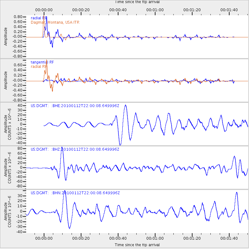
DGMT Dagmar, Montana, USA - Earthquake Result Viewer
*The percent match for this event was below the threshold and hence no stack was calculated.
| Earthquake location: |
Haiti Region |
| Earthquake latitude/longitude: |
18.4/-72.6 |
| Earthquake time(UTC): |
2010/01/12 (012) 21:53:10 GMT |
| Earthquake Depth: |
13 km |
| Earthquake Magnitude: |
6.8 MB, 7.3 MS, 7.0 MW, 7.0 MW |
| Earthquake Catalog/Contributor: |
WHDF/NEIC |
|
| Network: |
US United States National Seismic Network |
| Station: |
DGMT Dagmar, Montana, USA |
| Lat/Lon: |
48.47 N/104.20 W |
| Elevation: |
0.0 m |
|
| Distance: |
39.4 deg |
| Az: |
326.656 deg |
| Baz: |
128.367 deg |
| Ray Param: |
$rayparam |
*The percent match for this event was below the threshold and hence was not used in the summary stack. |
|
| Radial Match: |
95.749275 % |
| Radial Bump: |
223 |
| Transverse Match: |
68.65932 % |
| Transverse Bump: |
400 |
| SOD ConfigId: |
1 |
| Insert Time: |
2010-03-17 21:12:11.625 +0000 |
| GWidth: |
2.5 |
| Max Bumps: |
400 |
| Tol: |
0.001 |
|
Signal To Noise
| Channel | StoN | STA | LTA |
| US:DGMT: :BHZ:20100112T22:00:08.649996Z | 3.0290625 | 2.298522E-6 | 7.588229E-7 |
| US:DGMT: :BHN:20100112T22:00:08.649996Z | 0.45514697 | 1.2256718E-6 | 2.6929144E-6 |
| US:DGMT: :BHE:20100112T22:00:08.649996Z | 0.5146821 | 1.7533083E-6 | 3.406585E-6 |
| Arrivals |
| Ps | |
| PpPs | |
| PsPs/PpSs | |


