
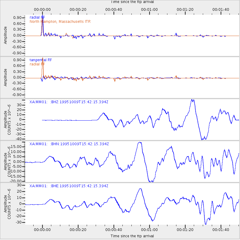
MM01 North Hampton, Massachusetts - Earthquake Result Viewer
| ||||||||||||||||||
| ||||||||||||||||||
| ||||||||||||||||||
|
Signal To Noise
| Channel | StoN | STA | LTA |
| XA:MM01: :BHN:19951009T15:42:15.394Z | 14.44869 | 3.499469E-6 | 2.4219972E-7 |
| XA:MM01: :BHE:19951009T15:42:15.394Z | 13.205417 | 4.247819E-6 | 3.2167247E-7 |
| XA:MM01: :BHZ:19951009T15:42:15.394Z | 28.861332 | 8.3592695E-6 | 2.896356E-7 |
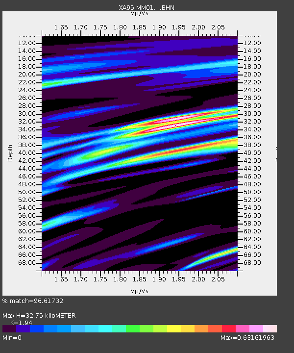
| Arrivals | |
| Ps | 5.1 SECOND |
| PpPs | 14 SECOND |
| PsPs/PpSs | 19 SECOND |

