You are here: Home > Network List > TA - USArray Transportable Network (new EarthScope stations) Stations List
> Station Z26A Caprock, NM, USA > Earthquake Result Viewer
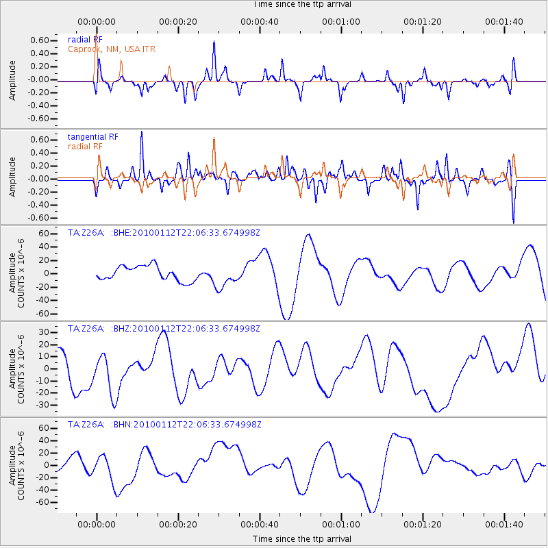
Z26A Caprock, NM, USA - Earthquake Result Viewer
*The percent match for this event was below the threshold and hence no stack was calculated.
| Earthquake location: |
Haiti Region |
| Earthquake latitude/longitude: |
18.4/-72.8 |
| Earthquake time(UTC): |
2010/01/12 (012) 22:00:41 GMT |
| Earthquake Depth: |
10 km |
| Earthquake Magnitude: |
6.0 MB |
| Earthquake Catalog/Contributor: |
WHDF/NEIC |
|
| Network: |
TA USArray Transportable Network (new EarthScope stations) |
| Station: |
Z26A Caprock, NM, USA |
| Lat/Lon: |
33.27 N/103.98 W |
| Elevation: |
1163 m |
|
| Distance: |
31.6 deg |
| Az: |
304.102 deg |
| Baz: |
110.19 deg |
| Ray Param: |
$rayparam |
*The percent match for this event was below the threshold and hence was not used in the summary stack. |
|
| Radial Match: |
59.931263 % |
| Radial Bump: |
272 |
| Transverse Match: |
62.007545 % |
| Transverse Bump: |
400 |
| SOD ConfigId: |
1 |
| Insert Time: |
2010-03-17 21:18:05.807 +0000 |
| GWidth: |
2.5 |
| Max Bumps: |
400 |
| Tol: |
0.001 |
|
Signal To Noise
| Channel | StoN | STA | LTA |
| TA:Z26A: :BHZ:20100112T22:06:33.674998Z | 0.8310517 | 1.7371158E-5 | 2.0902618E-5 |
| TA:Z26A: :BHN:20100112T22:06:33.674998Z | 1.2223228 | 2.2906741E-5 | 1.8740337E-5 |
| TA:Z26A: :BHE:20100112T22:06:33.674998Z | 1.6147203 | 1.7567178E-5 | 1.0879394E-5 |
| Arrivals |
| Ps | |
| PpPs | |
| PsPs/PpSs | |


