
MM01 North Hampton, Massachusetts - Earthquake Result Viewer
| ||||||||||||||||||
| ||||||||||||||||||
| ||||||||||||||||||
|
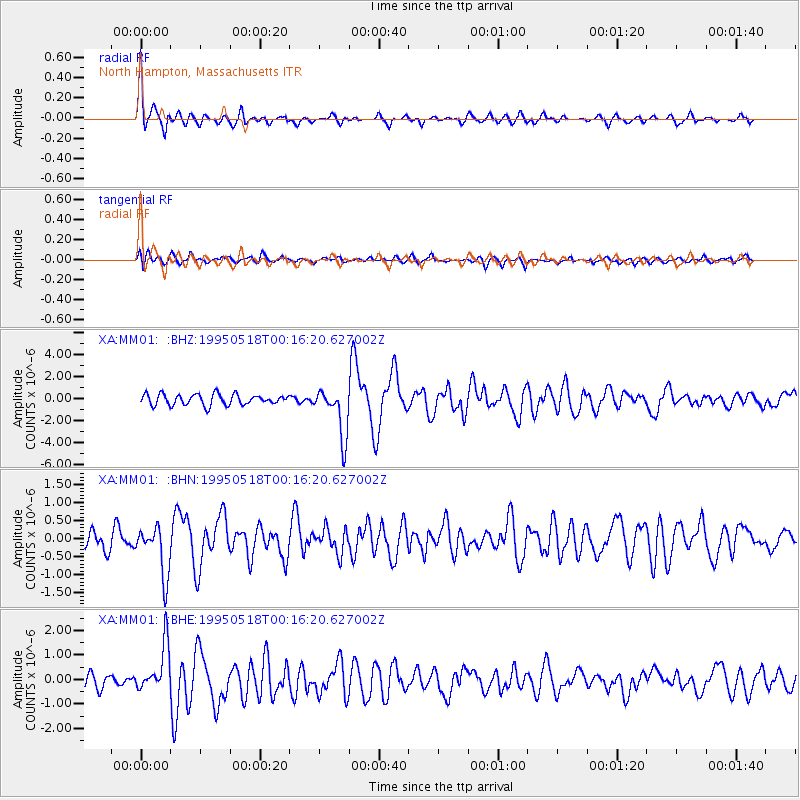
Signal To Noise
| Channel | StoN | STA | LTA |
| XA:MM01: :BHN:19950518T00:16:20.627002Z | 1.4590623 | 6.870155E-7 | 4.7086098E-7 |
| XA:MM01: :BHE:19950518T00:16:20.627002Z | 3.3925586 | 9.648194E-7 | 2.8439285E-7 |
| XA:MM01: :BHZ:19950518T00:16:20.627002Z | 4.6796365 | 2.2688932E-6 | 4.848439E-7 |
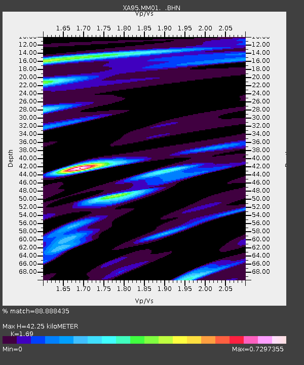
| Arrivals | |
| Ps | 4.8 SECOND |
| PpPs | 17 SECOND |
| PsPs/PpSs | 22 SECOND |

