You are here: Home > Network List > TA - USArray Transportable Network (new EarthScope stations) Stations List
> Station S28A Manter, KS, USA > Earthquake Result Viewer
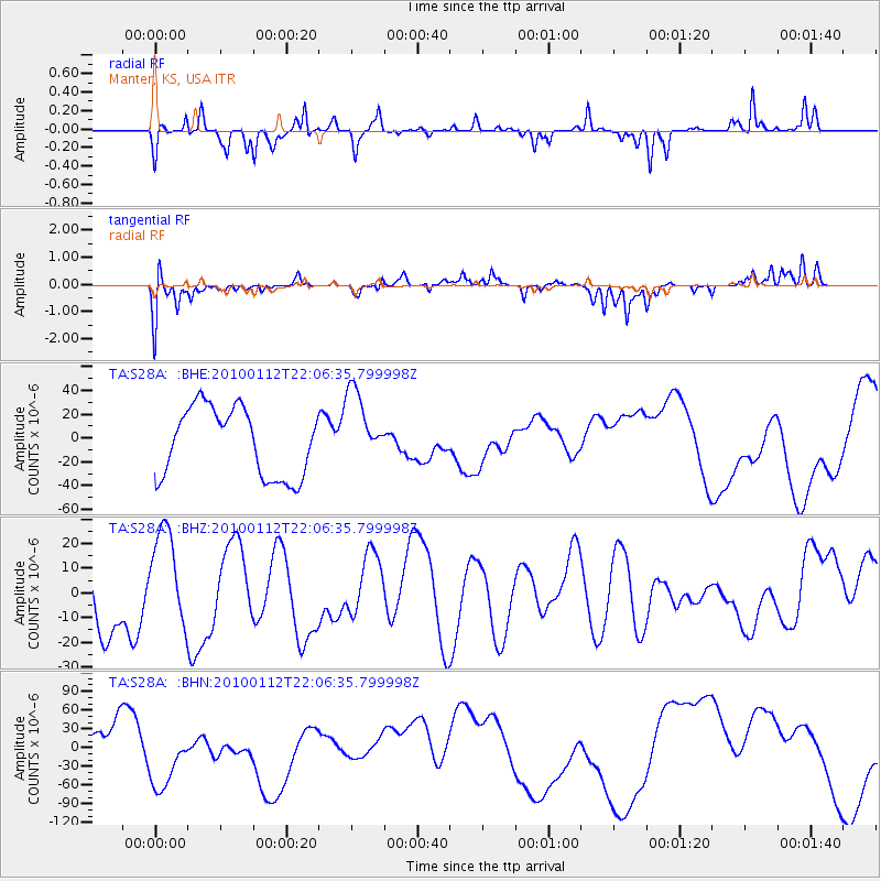
S28A Manter, KS, USA - Earthquake Result Viewer
*The percent match for this event was below the threshold and hence no stack was calculated.
| Earthquake location: |
Haiti Region |
| Earthquake latitude/longitude: |
18.4/-72.8 |
| Earthquake time(UTC): |
2010/01/12 (012) 22:00:41 GMT |
| Earthquake Depth: |
10 km |
| Earthquake Magnitude: |
6.0 MB |
| Earthquake Catalog/Contributor: |
WHDF/NEIC |
|
| Network: |
TA USArray Transportable Network (new EarthScope stations) |
| Station: |
S28A Manter, KS, USA |
| Lat/Lon: |
37.59 N/101.90 W |
| Elevation: |
1064 m |
|
| Distance: |
31.8 deg |
| Az: |
312.904 deg |
| Baz: |
118.883 deg |
| Ray Param: |
$rayparam |
*The percent match for this event was below the threshold and hence was not used in the summary stack. |
|
| Radial Match: |
52.013996 % |
| Radial Bump: |
185 |
| Transverse Match: |
65.53904 % |
| Transverse Bump: |
360 |
| SOD ConfigId: |
1 |
| Insert Time: |
2010-03-17 21:20:32.837 +0000 |
| GWidth: |
2.5 |
| Max Bumps: |
400 |
| Tol: |
0.001 |
|
Signal To Noise
| Channel | StoN | STA | LTA |
| TA:S28A: :BHZ:20100112T22:06:35.799998Z | 1.2884448 | 2.0405083E-5 | 1.5836986E-5 |
| TA:S28A: :BHN:20100112T22:06:35.799998Z | 2.2587154 | 4.9479524E-5 | 2.1906048E-5 |
| TA:S28A: :BHE:20100112T22:06:35.799998Z | 1.1016257 | 3.1827236E-5 | 2.8891152E-5 |
| Arrivals |
| Ps | |
| PpPs | |
| PsPs/PpSs | |


