You are here: Home > Network List > TA - USArray Transportable Network (new EarthScope stations) Stations List
> Station Q30A Quinter, KS, USA > Earthquake Result Viewer
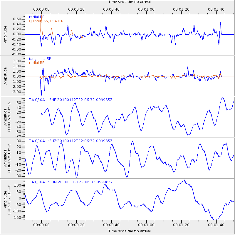
Q30A Quinter, KS, USA - Earthquake Result Viewer
*The percent match for this event was below the threshold and hence no stack was calculated.
| Earthquake location: |
Haiti Region |
| Earthquake latitude/longitude: |
18.4/-72.8 |
| Earthquake time(UTC): |
2010/01/12 (012) 22:00:41 GMT |
| Earthquake Depth: |
10 km |
| Earthquake Magnitude: |
6.0 MB |
| Earthquake Catalog/Contributor: |
WHDF/NEIC |
|
| Network: |
TA USArray Transportable Network (new EarthScope stations) |
| Station: |
Q30A Quinter, KS, USA |
| Lat/Lon: |
38.98 N/100.22 W |
| Elevation: |
797 m |
|
| Distance: |
31.4 deg |
| Az: |
316.463 deg |
| Baz: |
122.948 deg |
| Ray Param: |
$rayparam |
*The percent match for this event was below the threshold and hence was not used in the summary stack. |
|
| Radial Match: |
56.857796 % |
| Radial Bump: |
400 |
| Transverse Match: |
70.39851 % |
| Transverse Bump: |
400 |
| SOD ConfigId: |
1 |
| Insert Time: |
2010-03-17 21:21:00.518 +0000 |
| GWidth: |
2.5 |
| Max Bumps: |
400 |
| Tol: |
0.001 |
|
Signal To Noise
| Channel | StoN | STA | LTA |
| TA:Q30A: :BHZ:20100112T22:06:32.099985Z | 0.66674596 | 1.0574669E-5 | 1.5860118E-5 |
| TA:Q30A: :BHN:20100112T22:06:32.099985Z | 2.6513264 | 7.495993E-5 | 2.8272612E-5 |
| TA:Q30A: :BHE:20100112T22:06:32.099985Z | 1.1763141 | 3.943883E-5 | 3.3527464E-5 |
| Arrivals |
| Ps | |
| PpPs | |
| PsPs/PpSs | |


