You are here: Home > Network List > TA - USArray Transportable Network (new EarthScope stations) Stations List
> Station L02D Cave Junction, OR, USA > Earthquake Result Viewer
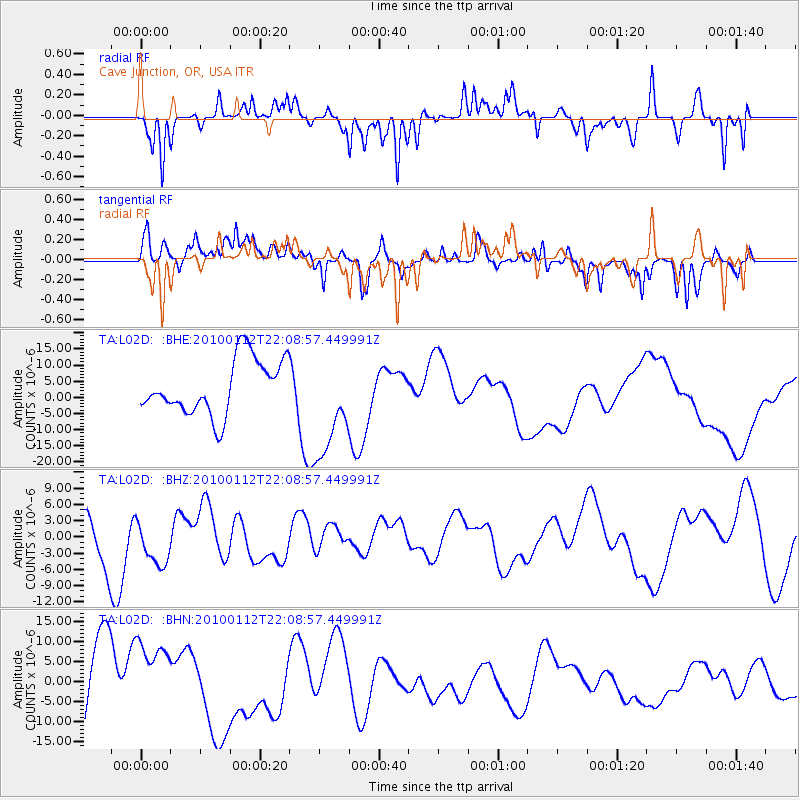
L02D Cave Junction, OR, USA - Earthquake Result Viewer
*The percent match for this event was below the threshold and hence no stack was calculated.
| Earthquake location: |
Haiti Region |
| Earthquake latitude/longitude: |
18.4/-72.8 |
| Earthquake time(UTC): |
2010/01/12 (012) 22:00:41 GMT |
| Earthquake Depth: |
10 km |
| Earthquake Magnitude: |
6.0 MB |
| Earthquake Catalog/Contributor: |
WHDF/NEIC |
|
| Network: |
TA USArray Transportable Network (new EarthScope stations) |
| Station: |
L02D Cave Junction, OR, USA |
| Lat/Lon: |
42.16 N/123.60 W |
| Elevation: |
458 m |
|
| Distance: |
49.0 deg |
| Az: |
310.237 deg |
| Baz: |
102.86 deg |
| Ray Param: |
$rayparam |
*The percent match for this event was below the threshold and hence was not used in the summary stack. |
|
| Radial Match: |
40.47157 % |
| Radial Bump: |
225 |
| Transverse Match: |
53.352623 % |
| Transverse Bump: |
400 |
| SOD ConfigId: |
1 |
| Insert Time: |
2010-03-17 21:21:58.992 +0000 |
| GWidth: |
2.5 |
| Max Bumps: |
400 |
| Tol: |
0.001 |
|
Signal To Noise
| Channel | StoN | STA | LTA |
| TA:L02D: :BHZ:20100112T22:08:57.449991Z | 1.2103176 | 4.5285246E-6 | 3.7416E-6 |
| TA:L02D: :BHN:20100112T22:08:57.449991Z | 1.3014816 | 9.904887E-6 | 7.61047E-6 |
| TA:L02D: :BHE:20100112T22:08:57.449991Z | 1.916869 | 1.6254604E-5 | 8.4797675E-6 |
| Arrivals |
| Ps | |
| PpPs | |
| PsPs/PpSs | |


