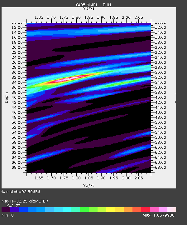
MM01 North Hampton, Massachusetts - Earthquake Result Viewer
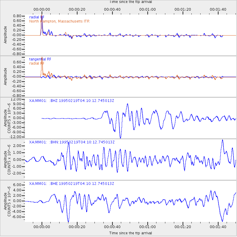
Earthquake location: Off Coast Of Northern California
Earthquake latitude/longitude: 40.6/-125.5
Earthquake time(UTC): 1995/02/19 (050) 04:03:16 GMT
Earthquake Depth: 10 km
Earthquake Magnitude: 6.1 MB, 6.8 MS, 6.7 UNKNOWN, 6.6 MD
Earthquake Catalog/Contributor: WHDF/NEIC
Network: XA Missouri to Massachusetts Transect
Station: MM01 North Hampton, Massachusetts
Lat/Lon: 42.32 N/72.71 W
Elevation: 122 m
Distance: 39.1 deg
Az: 69.519 deg
Baz: 285.78 deg
Ray Param: 0.0751762
Estimated Moho Depth: 32.25 km
Estimated Crust Vp/Vs: 1.77
Assumed Crust Vp: 6.419 km/s
Estimated Crust Vs: 3.627 km/s
Estimated Crust Poisson's Ratio: 0.27
Radial Match: 93.59656 %
Radial Bump: 316
Transverse Match: 76.75995 %
Transverse Bump: 400
SOD ConfigId: 6273
Insert Time: 2010-02-26 17:42:32.092 +0000
GWidth: 2.5
Max Bumps: 400
Tol: 0.001

Signal To Noise

ChannelStoNSTALTA
XA:MM01: :BHN:19950219T04:10:12.745013Z1.74559453.013686E-71.7264524E-7
XA:MM01: :BHE:19950219T04:10:12.745013Z2.35890444.553454E-71.9303259E-7
XA:MM01: :BHZ:19950219T04:10:12.745013Z7.82480539.1876484E-71.1741696E-7
Arrivals
Ps4.2 SECOND
PpPs13 SECOND
PsPs/PpSs17 SECOND