
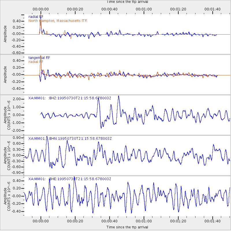
MM01 North Hampton, Massachusetts - Earthquake Result Viewer
| ||||||||||||||||||
| ||||||||||||||||||
| ||||||||||||||||||
|
Signal To Noise
| Channel | StoN | STA | LTA |
| XA:MM01: :BHN:19950730T21:15:58.678003Z | 3.8853242 | 4.4139944E-7 | 1.13606845E-7 |
| XA:MM01: :BHE:19950730T21:15:58.678003Z | 1.5089163 | 1.905702E-7 | 1.2629607E-7 |
| XA:MM01: :BHZ:19950730T21:15:58.678003Z | 5.600562 | 9.036077E-7 | 1.6134233E-7 |
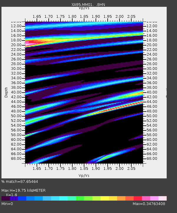
| Arrivals | |
| Ps | 1.9 SECOND |
| PpPs | 7.6 SECOND |
| PsPs/PpSs | 9.6 SECOND |

