You are here: Home > Network List > CI - Caltech Regional Seismic Network Stations List
> Station RCT Rector, Visalia, CA, USA > Earthquake Result Viewer
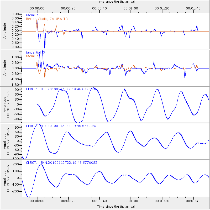
RCT Rector, Visalia, CA, USA - Earthquake Result Viewer
*The percent match for this event was below the threshold and hence no stack was calculated.
| Earthquake location: |
Haiti Region |
| Earthquake latitude/longitude: |
18.5/-72.5 |
| Earthquake time(UTC): |
2010/01/12 (012) 22:12:04 GMT |
| Earthquake Depth: |
10 km |
| Earthquake Magnitude: |
5.7 MB |
| Earthquake Catalog/Contributor: |
WHDF/NEIC |
|
| Network: |
CI Caltech Regional Seismic Network |
| Station: |
RCT Rector, Visalia, CA, USA |
| Lat/Lon: |
36.31 N/119.24 W |
| Elevation: |
107 m |
|
| Distance: |
44.7 deg |
| Az: |
303.234 deg |
| Baz: |
100.606 deg |
| Ray Param: |
$rayparam |
*The percent match for this event was below the threshold and hence was not used in the summary stack. |
|
| Radial Match: |
84.138855 % |
| Radial Bump: |
373 |
| Transverse Match: |
58.1972 % |
| Transverse Bump: |
400 |
| SOD ConfigId: |
1 |
| Insert Time: |
2010-03-17 21:28:44.226 +0000 |
| GWidth: |
2.5 |
| Max Bumps: |
400 |
| Tol: |
0.001 |
|
Signal To Noise
| Channel | StoN | STA | LTA |
| CI:RCT: :BHZ:20100112T22:19:46.677008Z | 1.7193824 | 1.132639E-4 | 6.587476E-5 |
| CI:RCT: :BHN:20100112T22:19:46.677008Z | 0.7928445 | 1.6625863E-4 | 2.0969893E-4 |
| CI:RCT: :BHE:20100112T22:19:46.677008Z | 1.0712494 | 6.496355E-5 | 6.064279E-5 |
| Arrivals |
| Ps | |
| PpPs | |
| PsPs/PpSs | |


