You are here: Home > Network List > CI - Caltech Regional Seismic Network Stations List
> Station SMM Simmler, CA, USA > Earthquake Result Viewer
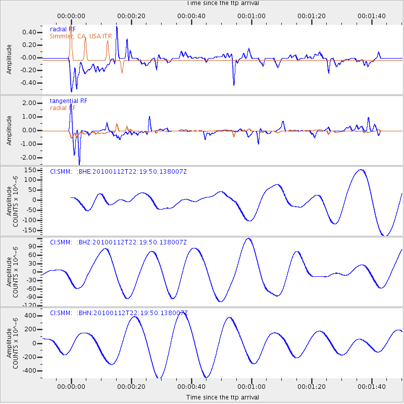
SMM Simmler, CA, USA - Earthquake Result Viewer
*The percent match for this event was below the threshold and hence no stack was calculated.
| Earthquake location: |
Haiti Region |
| Earthquake latitude/longitude: |
18.5/-72.5 |
| Earthquake time(UTC): |
2010/01/12 (012) 22:12:04 GMT |
| Earthquake Depth: |
10 km |
| Earthquake Magnitude: |
5.7 MB |
| Earthquake Catalog/Contributor: |
WHDF/NEIC |
|
| Network: |
CI Caltech Regional Seismic Network |
| Station: |
SMM Simmler, CA, USA |
| Lat/Lon: |
35.31 N/120.00 W |
| Elevation: |
599 m |
|
| Distance: |
45.1 deg |
| Az: |
301.706 deg |
| Baz: |
99.085 deg |
| Ray Param: |
$rayparam |
*The percent match for this event was below the threshold and hence was not used in the summary stack. |
|
| Radial Match: |
79.89269 % |
| Radial Bump: |
400 |
| Transverse Match: |
88.20479 % |
| Transverse Bump: |
386 |
| SOD ConfigId: |
1 |
| Insert Time: |
2010-03-17 21:28:58.300 +0000 |
| GWidth: |
2.5 |
| Max Bumps: |
400 |
| Tol: |
0.001 |
|
Signal To Noise
| Channel | StoN | STA | LTA |
| CI:SMM: :BHZ:20100112T22:19:50.138007Z | 2.0907047 | 4.395423E-5 | 2.1023645E-5 |
| CI:SMM: :BHN:20100112T22:19:50.138007Z | 1.0601808 | 1.1160111E-4 | 1.0526611E-4 |
| CI:SMM: :BHE:20100112T22:19:50.138007Z | 1.6223432 | 3.8637052E-5 | 2.3815586E-5 |
| Arrivals |
| Ps | |
| PpPs | |
| PsPs/PpSs | |


