You are here: Home > Network List > XA95 - Missouri to Massachusetts Transect Stations List
> Station MM01 North Hampton, Massachusetts > Earthquake Result Viewer
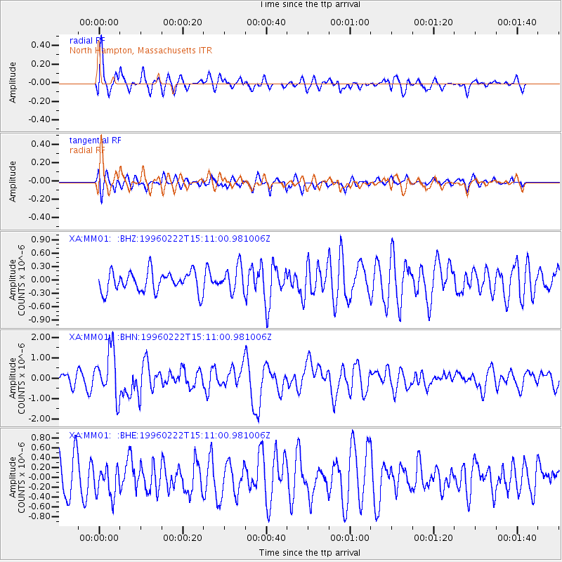
MM01 North Hampton, Massachusetts - Earthquake Result Viewer
*The percent match for this event was below the threshold and hence no stack was calculated.
| Earthquake location: |
Kuril Islands |
| Earthquake latitude/longitude: |
45.2/148.6 |
| Earthquake time(UTC): |
1996/02/22 (053) 14:59:09 GMT |
| Earthquake Depth: |
133 km |
| Earthquake Magnitude: |
6.2 MB, 6.3 UNKNOWN, 6.3 MW |
| Earthquake Catalog/Contributor: |
WHDF/NEIC |
|
| Network: |
XA Missouri to Massachusetts Transect |
| Station: |
MM01 North Hampton, Massachusetts |
| Lat/Lon: |
42.32 N/72.71 W |
| Elevation: |
122 m |
|
| Distance: |
85.4 deg |
| Az: |
29.392 deg |
| Baz: |
332.109 deg |
| Ray Param: |
$rayparam |
*The percent match for this event was below the threshold and hence was not used in the summary stack. |
|
| Radial Match: |
70.17905 % |
| Radial Bump: |
400 |
| Transverse Match: |
68.27797 % |
| Transverse Bump: |
400 |
| SOD ConfigId: |
4480 |
| Insert Time: |
2010-02-26 17:42:47.093 +0000 |
| GWidth: |
2.5 |
| Max Bumps: |
400 |
| Tol: |
0.001 |
|
Signal To Noise
| Channel | StoN | STA | LTA |
| XA:MM01: :BHN:19960222T15:11:00.981006Z | 3.035695 | 1.1963947E-6 | 3.94109E-7 |
| XA:MM01: :BHE:19960222T15:11:00.981006Z | 0.8453635 | 3.0767657E-7 | 3.6395772E-7 |
| XA:MM01: :BHZ:19960222T15:11:00.981006Z | 1.2911574 | 2.918883E-7 | 2.260672E-7 |
| Arrivals |
| Ps | |
| PpPs | |
| PsPs/PpSs | |


