You are here: Home > Network List > US - United States National Seismic Network Stations List
> Station HAWA Hanford, Washington, USA > Earthquake Result Viewer
HAWA Hanford, Washington, USA - Earthquake Result Viewer
*The percent match for this event was below the threshold and hence no stack was calculated.
| Earthquake location: |
Fiji Islands Region |
| Earthquake latitude/longitude: |
-21.0/-178.9 |
| Earthquake time(UTC): |
2022/09/11 (254) 09:06:51 GMT |
| Earthquake Depth: |
630 km |
| Earthquake Magnitude: |
5.5 mb |
| Earthquake Catalog/Contributor: |
NEIC PDE/us |
|
| Network: |
US United States National Seismic Network |
| Station: |
HAWA Hanford, Washington, USA |
| Lat/Lon: |
46.39 N/119.53 W |
| Elevation: |
364 m |
|
| Distance: |
85.9 deg |
| Az: |
36.683 deg |
| Baz: |
233.765 deg |
| Ray Param: |
$rayparam |
*The percent match for this event was below the threshold and hence was not used in the summary stack. |
|
| Radial Match: |
38.885967 % |
| Radial Bump: |
400 |
| Transverse Match: |
40.623055 % |
| Transverse Bump: |
400 |
| SOD ConfigId: |
28764291 |
| Insert Time: |
2022-09-25 09:43:01.887 +0000 |
| GWidth: |
2.5 |
| Max Bumps: |
400 |
| Tol: |
0.001 |
|
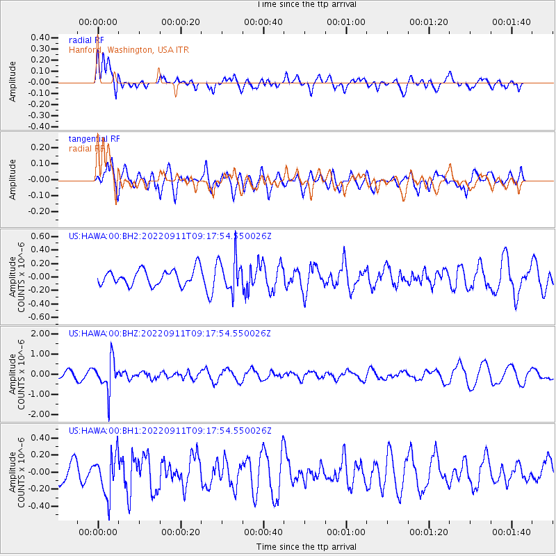
Signal To Noise
| Channel | StoN | STA | LTA |
| US:HAWA:00:BHZ:20220911T09:17:54.550026Z | 4.837166 | 7.748425E-7 | 1.6018522E-7 |
| US:HAWA:00:BH1:20220911T09:17:54.550026Z | 1.5112289 | 2.4126987E-7 | 1.5965145E-7 |
| US:HAWA:00:BH2:20220911T09:17:54.550026Z | 2.120984 | 2.4379548E-7 | 1.1494451E-7 |
| Arrivals |
| Ps | |
| PpPs | |
| PsPs/PpSs | |


