You are here: Home > Network List > XA95 - Missouri to Massachusetts Transect Stations List
> Station MM01 North Hampton, Massachusetts > Earthquake Result Viewer
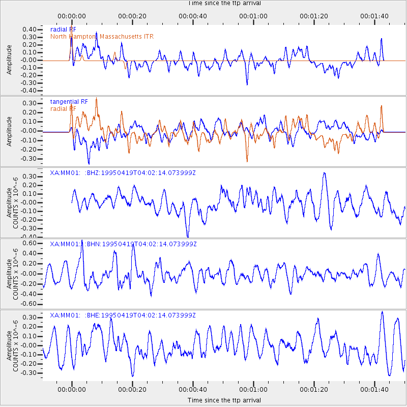
MM01 North Hampton, Massachusetts - Earthquake Result Viewer
*The percent match for this event was below the threshold and hence no stack was calculated.
| Earthquake location: |
Kuril Islands |
| Earthquake latitude/longitude: |
44.0/148.2 |
| Earthquake time(UTC): |
1995/04/19 (109) 03:50:05 GMT |
| Earthquake Depth: |
33 km |
| Earthquake Magnitude: |
5.9 MB, 5.5 MS, 5.8 UNKNOWN, 5.7 MW |
| Earthquake Catalog/Contributor: |
WHDF/NEIC |
|
| Network: |
XA Missouri to Massachusetts Transect |
| Station: |
MM01 North Hampton, Massachusetts |
| Lat/Lon: |
42.32 N/72.71 W |
| Elevation: |
122 m |
|
| Distance: |
86.5 deg |
| Az: |
29.12 deg |
| Baz: |
331.751 deg |
| Ray Param: |
$rayparam |
*The percent match for this event was below the threshold and hence was not used in the summary stack. |
|
| Radial Match: |
50.04594 % |
| Radial Bump: |
400 |
| Transverse Match: |
43.423378 % |
| Transverse Bump: |
400 |
| SOD ConfigId: |
4480 |
| Insert Time: |
2010-02-26 17:42:51.014 +0000 |
| GWidth: |
2.5 |
| Max Bumps: |
400 |
| Tol: |
0.001 |
|
Signal To Noise
| Channel | StoN | STA | LTA |
| XA:MM01: :BHN:19950419T04:02:14.073999Z | 2.5234332 | 2.8383027E-7 | 1.1247782E-7 |
| XA:MM01: :BHE:19950419T04:02:14.073999Z | 1.3961748 | 1.3101211E-7 | 9.383646E-8 |
| XA:MM01: :BHZ:19950419T04:02:14.073999Z | 1.6317672 | 1.08660196E-7 | 6.65905E-8 |
| Arrivals |
| Ps | |
| PpPs | |
| PsPs/PpSs | |


