You are here: Home > Network List > XA95 - Missouri to Massachusetts Transect Stations List
> Station MM01 North Hampton, Massachusetts > Earthquake Result Viewer
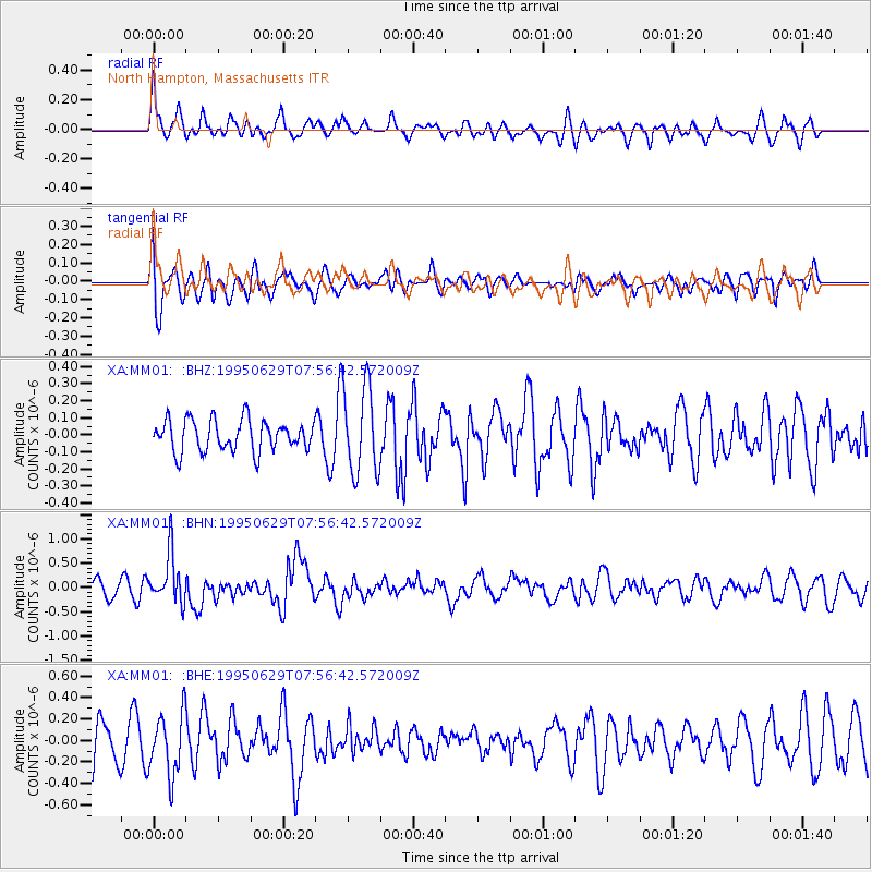
MM01 North Hampton, Massachusetts - Earthquake Result Viewer
*The percent match for this event was below the threshold and hence no stack was calculated.
| Earthquake location: |
Kuril Islands |
| Earthquake latitude/longitude: |
48.8/154.5 |
| Earthquake time(UTC): |
1995/06/29 (180) 07:45:09 GMT |
| Earthquake Depth: |
62 km |
| Earthquake Magnitude: |
5.9 MB, 6.0 UNKNOWN, 6.0 MW |
| Earthquake Catalog/Contributor: |
WHDF/NEIC |
|
| Network: |
XA Missouri to Massachusetts Transect |
| Station: |
MM01 North Hampton, Massachusetts |
| Lat/Lon: |
42.32 N/72.71 W |
| Elevation: |
122 m |
|
| Distance: |
80.2 deg |
| Az: |
33.499 deg |
| Baz: |
330.515 deg |
| Ray Param: |
$rayparam |
*The percent match for this event was below the threshold and hence was not used in the summary stack. |
|
| Radial Match: |
61.776657 % |
| Radial Bump: |
400 |
| Transverse Match: |
69.1154 % |
| Transverse Bump: |
400 |
| SOD ConfigId: |
4480 |
| Insert Time: |
2010-02-26 17:42:53.624 +0000 |
| GWidth: |
2.5 |
| Max Bumps: |
400 |
| Tol: |
0.001 |
|
Signal To Noise
| Channel | StoN | STA | LTA |
| XA:MM01: :BHN:19950629T07:56:42.572009Z | 2.826991 | 5.1147225E-7 | 1.809246E-7 |
| XA:MM01: :BHE:19950629T07:56:42.572009Z | 1.676295 | 2.882565E-7 | 1.7196048E-7 |
| XA:MM01: :BHZ:19950629T07:56:42.572009Z | 2.8683412 | 2.6175644E-7 | 9.125708E-8 |
| Arrivals |
| Ps | |
| PpPs | |
| PsPs/PpSs | |


