You are here: Home > Network List > US - United States National Seismic Network Stations List
> Station AMTX Amarillo, Texas, USA > Earthquake Result Viewer
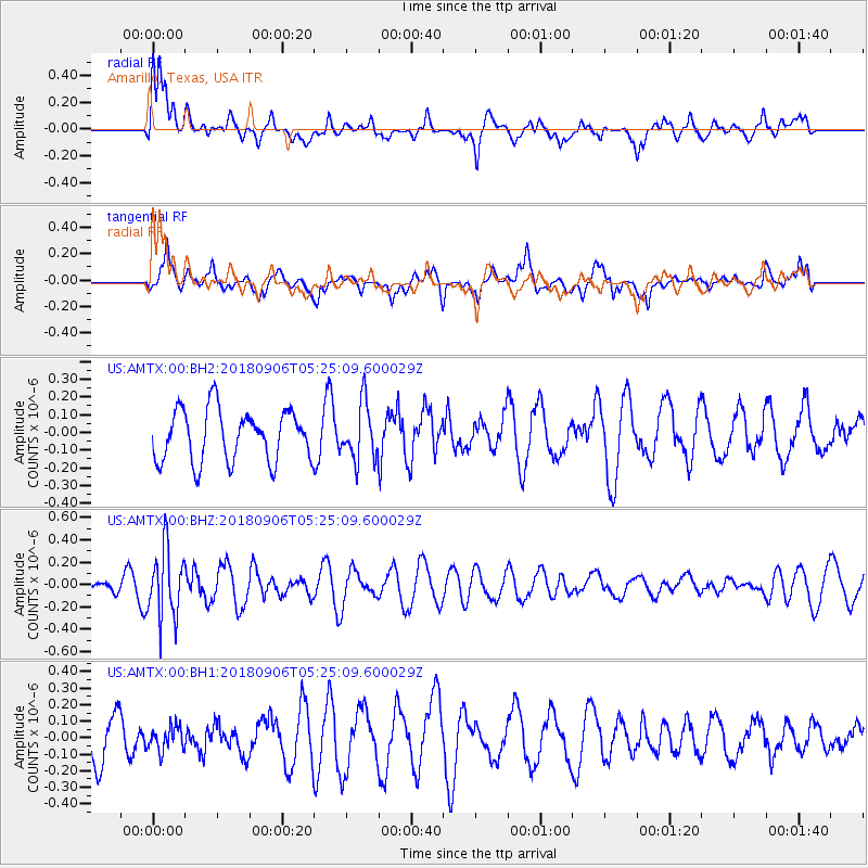
AMTX Amarillo, Texas, USA - Earthquake Result Viewer
*The percent match for this event was below the threshold and hence no stack was calculated.
| Earthquake location: |
Fiji Islands Region |
| Earthquake latitude/longitude: |
-18.0/-178.5 |
| Earthquake time(UTC): |
2018/09/06 (249) 05:13:39 GMT |
| Earthquake Depth: |
531 km |
| Earthquake Magnitude: |
5.5 Mww |
| Earthquake Catalog/Contributor: |
NEIC PDE/us |
|
| Network: |
US United States National Seismic Network |
| Station: |
AMTX Amarillo, Texas, USA |
| Lat/Lon: |
34.53 N/101.41 W |
| Elevation: |
1010 m |
|
| Distance: |
89.9 deg |
| Az: |
53.594 deg |
| Baz: |
248.102 deg |
| Ray Param: |
$rayparam |
*The percent match for this event was below the threshold and hence was not used in the summary stack. |
|
| Radial Match: |
69.325905 % |
| Radial Bump: |
400 |
| Transverse Match: |
56.39271 % |
| Transverse Bump: |
382 |
| SOD ConfigId: |
2825771 |
| Insert Time: |
2018-09-20 05:30:11.659 +0000 |
| GWidth: |
2.5 |
| Max Bumps: |
400 |
| Tol: |
0.001 |
|
Signal To Noise
| Channel | StoN | STA | LTA |
| US:AMTX:00:BHZ:20180906T05:25:09.600029Z | 2.6081657 | 3.0728953E-7 | 1.1781826E-7 |
| US:AMTX:00:BH1:20180906T05:25:09.600029Z | 0.51874757 | 7.0566145E-8 | 1.3603177E-7 |
| US:AMTX:00:BH2:20180906T05:25:09.600029Z | 1.1427373 | 1.6724674E-7 | 1.4635626E-7 |
| Arrivals |
| Ps | |
| PpPs | |
| PsPs/PpSs | |


