You are here: Home > Network List > US - United States National Seismic Network Stations List
> Station LAO LASA Array, Montana, USA > Earthquake Result Viewer
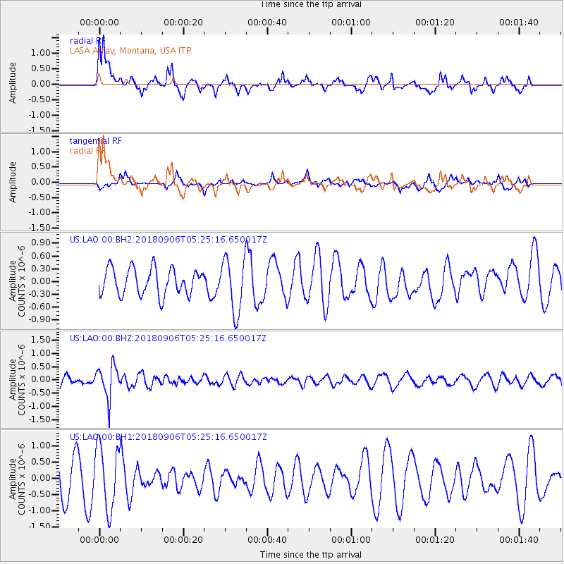
LAO LASA Array, Montana, USA - Earthquake Result Viewer
*The percent match for this event was below the threshold and hence no stack was calculated.
| Earthquake location: |
Fiji Islands Region |
| Earthquake latitude/longitude: |
-18.0/-178.5 |
| Earthquake time(UTC): |
2018/09/06 (249) 05:13:39 GMT |
| Earthquake Depth: |
531 km |
| Earthquake Magnitude: |
5.5 Mww |
| Earthquake Catalog/Contributor: |
NEIC PDE/us |
|
| Network: |
US United States National Seismic Network |
| Station: |
LAO LASA Array, Montana, USA |
| Lat/Lon: |
46.69 N/106.22 W |
| Elevation: |
902 m |
|
| Distance: |
91.3 deg |
| Az: |
40.996 deg |
| Baz: |
245.096 deg |
| Ray Param: |
$rayparam |
*The percent match for this event was below the threshold and hence was not used in the summary stack. |
|
| Radial Match: |
70.1749 % |
| Radial Bump: |
400 |
| Transverse Match: |
44.1452 % |
| Transverse Bump: |
400 |
| SOD ConfigId: |
2825771 |
| Insert Time: |
2018-09-20 05:30:40.165 +0000 |
| GWidth: |
2.5 |
| Max Bumps: |
400 |
| Tol: |
0.001 |
|
Signal To Noise
| Channel | StoN | STA | LTA |
| US:LAO:00:BHZ:20180906T05:25:16.650017Z | 3.225716 | 6.191756E-7 | 1.9194982E-7 |
| US:LAO:00:BH1:20180906T05:25:16.650017Z | 1.2826802 | 1.0009957E-6 | 7.8039375E-7 |
| US:LAO:00:BH2:20180906T05:25:16.650017Z | 2.110633 | 6.522517E-7 | 3.0903135E-7 |
| Arrivals |
| Ps | |
| PpPs | |
| PsPs/PpSs | |


