You are here: Home > Network List > TA - USArray Transportable Network (new EarthScope stations) Stations List
> Station U23A El Rito, NM, USA > Earthquake Result Viewer
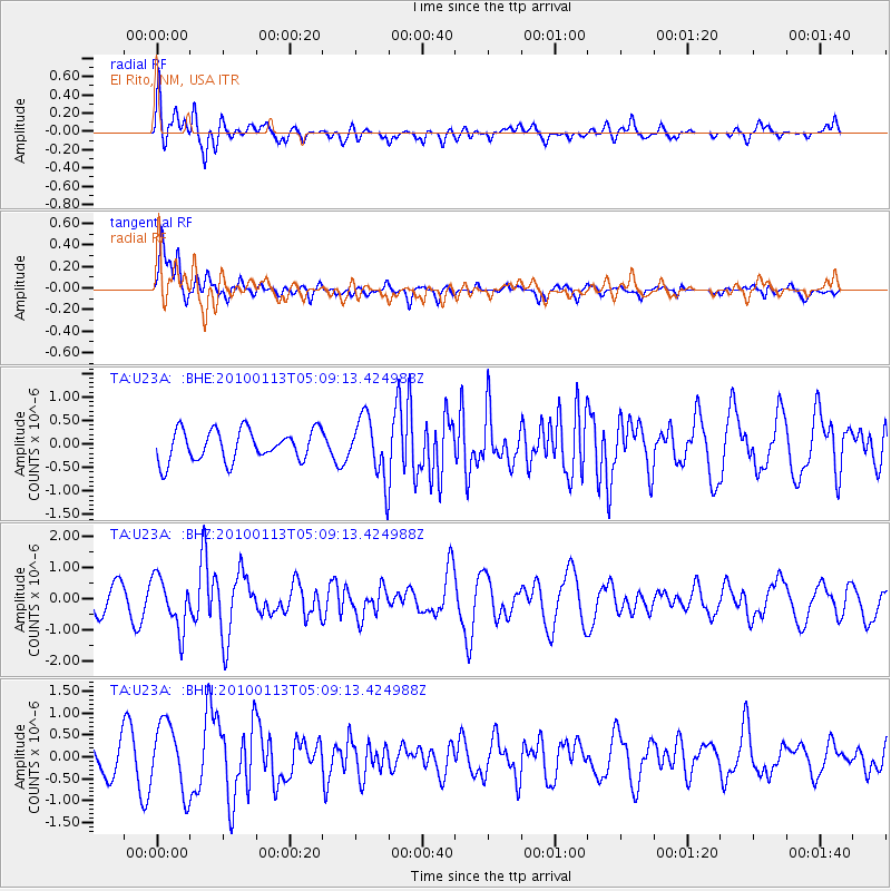
U23A El Rito, NM, USA - Earthquake Result Viewer
*The percent match for this event was below the threshold and hence no stack was calculated.
| Earthquake location: |
Haiti Region |
| Earthquake latitude/longitude: |
18.4/-72.9 |
| Earthquake time(UTC): |
2010/01/13 (013) 05:02:57 GMT |
| Earthquake Depth: |
10 km |
| Earthquake Magnitude: |
5.7 MB, 5.6 MS, 5.8 MW, 5.8 MW |
| Earthquake Catalog/Contributor: |
WHDF/NEIC |
|
| Network: |
TA USArray Transportable Network (new EarthScope stations) |
| Station: |
U23A El Rito, NM, USA |
| Lat/Lon: |
36.33 N/106.19 W |
| Elevation: |
2093 m |
|
| Distance: |
34.3 deg |
| Az: |
308.197 deg |
| Baz: |
112.446 deg |
| Ray Param: |
$rayparam |
*The percent match for this event was below the threshold and hence was not used in the summary stack. |
|
| Radial Match: |
68.39649 % |
| Radial Bump: |
400 |
| Transverse Match: |
87.80229 % |
| Transverse Bump: |
400 |
| SOD ConfigId: |
1 |
| Insert Time: |
2010-03-17 21:52:24.966 +0000 |
| GWidth: |
2.5 |
| Max Bumps: |
400 |
| Tol: |
0.001 |
|
Signal To Noise
| Channel | StoN | STA | LTA |
| TA:U23A: :BHZ:20100113T05:09:13.424988Z | 2.0562117 | 8.225063E-7 | 4.0001052E-7 |
| TA:U23A: :BHN:20100113T05:09:13.424988Z | 1.8628343 | 7.7717704E-7 | 4.1720136E-7 |
| TA:U23A: :BHE:20100113T05:09:13.424988Z | 1.9695683 | 6.451702E-7 | 3.2756935E-7 |
| Arrivals |
| Ps | |
| PpPs | |
| PsPs/PpSs | |


