You are here: Home > Network List > TA - USArray Transportable Network (new EarthScope stations) Stations List
> Station S28A Manter, KS, USA > Earthquake Result Viewer
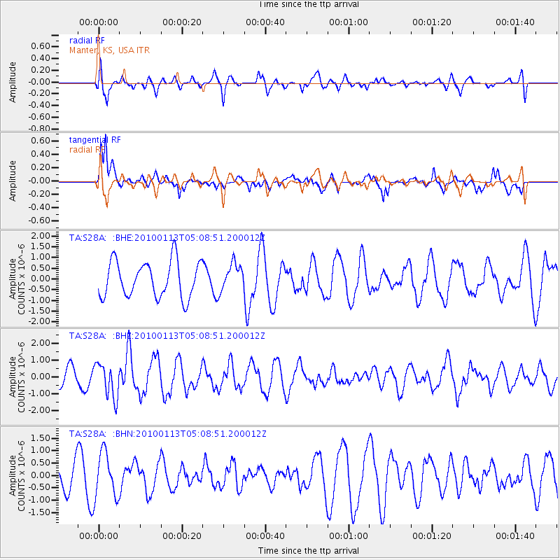
S28A Manter, KS, USA - Earthquake Result Viewer
*The percent match for this event was below the threshold and hence no stack was calculated.
| Earthquake location: |
Haiti Region |
| Earthquake latitude/longitude: |
18.4/-72.9 |
| Earthquake time(UTC): |
2010/01/13 (013) 05:02:57 GMT |
| Earthquake Depth: |
10 km |
| Earthquake Magnitude: |
5.7 MB, 5.6 MS, 5.8 MW, 5.8 MW |
| Earthquake Catalog/Contributor: |
WHDF/NEIC |
|
| Network: |
TA USArray Transportable Network (new EarthScope stations) |
| Station: |
S28A Manter, KS, USA |
| Lat/Lon: |
37.59 N/101.90 W |
| Elevation: |
1064 m |
|
| Distance: |
31.8 deg |
| Az: |
313.015 deg |
| Baz: |
119.057 deg |
| Ray Param: |
$rayparam |
*The percent match for this event was below the threshold and hence was not used in the summary stack. |
|
| Radial Match: |
70.81875 % |
| Radial Bump: |
400 |
| Transverse Match: |
76.59555 % |
| Transverse Bump: |
400 |
| SOD ConfigId: |
1 |
| Insert Time: |
2010-03-17 21:58:16.257 +0000 |
| GWidth: |
2.5 |
| Max Bumps: |
400 |
| Tol: |
0.001 |
|
Signal To Noise
| Channel | StoN | STA | LTA |
| TA:S28A: :BHZ:20100113T05:08:51.200012Z | 2.3008785 | 1.012107E-6 | 4.398785E-7 |
| TA:S28A: :BHN:20100113T05:08:51.200012Z | 1.2841234 | 8.806048E-7 | 6.857634E-7 |
| TA:S28A: :BHE:20100113T05:08:51.200012Z | 0.72853255 | 6.1047143E-7 | 8.379467E-7 |
| Arrivals |
| Ps | |
| PpPs | |
| PsPs/PpSs | |


