You are here: Home > Network List > CI - Caltech Regional Seismic Network Stations List
> Station TIN Tinemaha, Big Pine, CA, USA > Earthquake Result Viewer
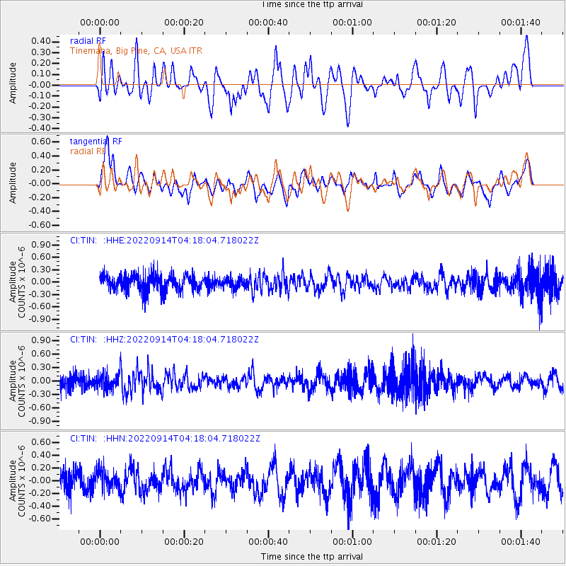
TIN Tinemaha, Big Pine, CA, USA - Earthquake Result Viewer
*The percent match for this event was below the threshold and hence no stack was calculated.
| Earthquake location: |
South Of Mariana Islands |
| Earthquake latitude/longitude: |
12.0/143.6 |
| Earthquake time(UTC): |
2022/09/14 (257) 04:05:42 GMT |
| Earthquake Depth: |
27 km |
| Earthquake Magnitude: |
5.3 Mww |
| Earthquake Catalog/Contributor: |
NEIC PDE/us |
|
| Network: |
CI Caltech Regional Seismic Network |
| Station: |
TIN Tinemaha, Big Pine, CA, USA |
| Lat/Lon: |
37.05 N/118.23 W |
| Elevation: |
1197 m |
|
| Distance: |
89.3 deg |
| Az: |
52.365 deg |
| Baz: |
284.416 deg |
| Ray Param: |
$rayparam |
*The percent match for this event was below the threshold and hence was not used in the summary stack. |
|
| Radial Match: |
54.475597 % |
| Radial Bump: |
400 |
| Transverse Match: |
64.483765 % |
| Transverse Bump: |
400 |
| SOD ConfigId: |
28764291 |
| Insert Time: |
2022-09-28 04:16:58.490 +0000 |
| GWidth: |
2.5 |
| Max Bumps: |
400 |
| Tol: |
0.001 |
|
Signal To Noise
| Channel | StoN | STA | LTA |
| CI:TIN: :HHZ:20220914T04:18:04.718022Z | 0.6058386 | 1.7284755E-7 | 2.8530297E-7 |
| CI:TIN: :HHN:20220914T04:18:04.718022Z | 0.7854606 | 1.5528677E-7 | 1.9770154E-7 |
| CI:TIN: :HHE:20220914T04:18:04.718022Z | 0.64440125 | 1.2611858E-7 | 1.9571436E-7 |
| Arrivals |
| Ps | |
| PpPs | |
| PsPs/PpSs | |


