You are here: Home > Network List > CN - Canadian National Seismograph Network Stations List
> Station INK INUVIK, NT > Earthquake Result Viewer
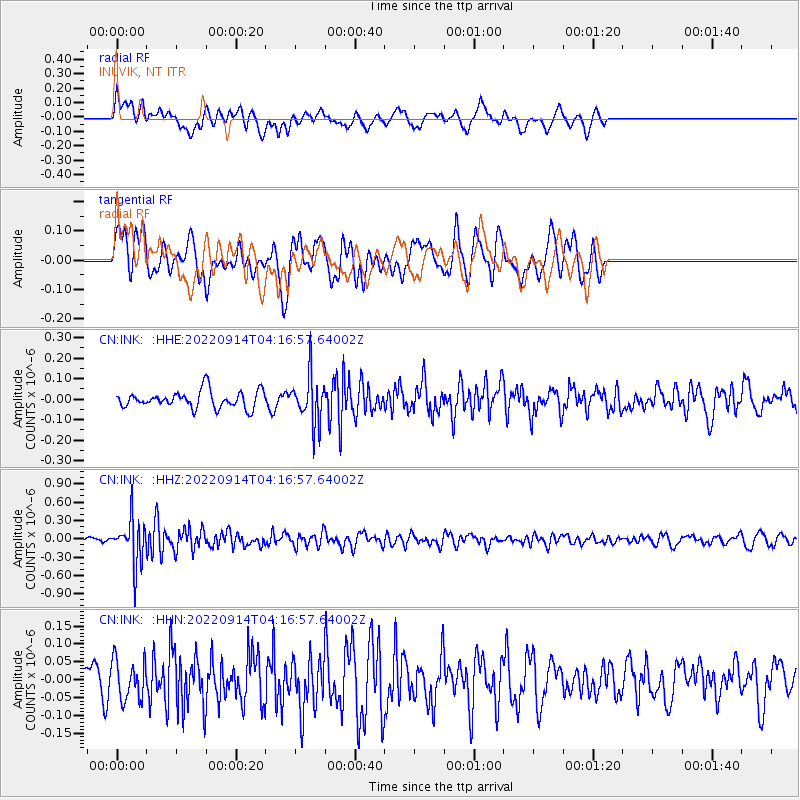
INK INUVIK, NT - Earthquake Result Viewer
*The percent match for this event was below the threshold and hence no stack was calculated.
| Earthquake location: |
South Of Mariana Islands |
| Earthquake latitude/longitude: |
12.0/143.6 |
| Earthquake time(UTC): |
2022/09/14 (257) 04:05:42 GMT |
| Earthquake Depth: |
27 km |
| Earthquake Magnitude: |
5.3 Mww |
| Earthquake Catalog/Contributor: |
NEIC PDE/us |
|
| Network: |
CN Canadian National Seismograph Network |
| Station: |
INK INUVIK, NT |
| Lat/Lon: |
68.31 N/133.53 W |
| Elevation: |
44 m |
|
| Distance: |
76.3 deg |
| Az: |
22.318 deg |
| Baz: |
267.902 deg |
| Ray Param: |
$rayparam |
*The percent match for this event was below the threshold and hence was not used in the summary stack. |
|
| Radial Match: |
58.958908 % |
| Radial Bump: |
400 |
| Transverse Match: |
59.57559 % |
| Transverse Bump: |
400 |
| SOD ConfigId: |
28764291 |
| Insert Time: |
2022-09-28 04:17:48.515 +0000 |
| GWidth: |
2.5 |
| Max Bumps: |
400 |
| Tol: |
0.001 |
|
Signal To Noise
| Channel | StoN | STA | LTA |
| CN:INK: :HHZ:20220914T04:16:57.64002Z | 4.4440503 | 3.605862E-7 | 8.1139085E-8 |
| CN:INK: :HHN:20220914T04:16:57.64002Z | 1.421308 | 5.512798E-8 | 3.878679E-8 |
| CN:INK: :HHE:20220914T04:16:57.64002Z | 2.770214 | 1.15854185E-7 | 4.182138E-8 |
| Arrivals |
| Ps | |
| PpPs | |
| PsPs/PpSs | |


