You are here: Home > Network List > US - United States National Seismic Network Stations List
> Station HAWA Hanford, Washington, USA > Earthquake Result Viewer
HAWA Hanford, Washington, USA - Earthquake Result Viewer
*The percent match for this event was below the threshold and hence no stack was calculated.
| Earthquake location: |
South Of Mariana Islands |
| Earthquake latitude/longitude: |
12.0/143.6 |
| Earthquake time(UTC): |
2022/09/14 (257) 04:05:42 GMT |
| Earthquake Depth: |
27 km |
| Earthquake Magnitude: |
5.3 Mww |
| Earthquake Catalog/Contributor: |
NEIC PDE/us |
|
| Network: |
US United States National Seismic Network |
| Station: |
HAWA Hanford, Washington, USA |
| Lat/Lon: |
46.39 N/119.53 W |
| Elevation: |
364 m |
|
| Distance: |
86.1 deg |
| Az: |
43.531 deg |
| Baz: |
283.193 deg |
| Ray Param: |
$rayparam |
*The percent match for this event was below the threshold and hence was not used in the summary stack. |
|
| Radial Match: |
49.579853 % |
| Radial Bump: |
400 |
| Transverse Match: |
53.08288 % |
| Transverse Bump: |
400 |
| SOD ConfigId: |
28764291 |
| Insert Time: |
2022-09-28 04:25:01.671 +0000 |
| GWidth: |
2.5 |
| Max Bumps: |
400 |
| Tol: |
0.001 |
|
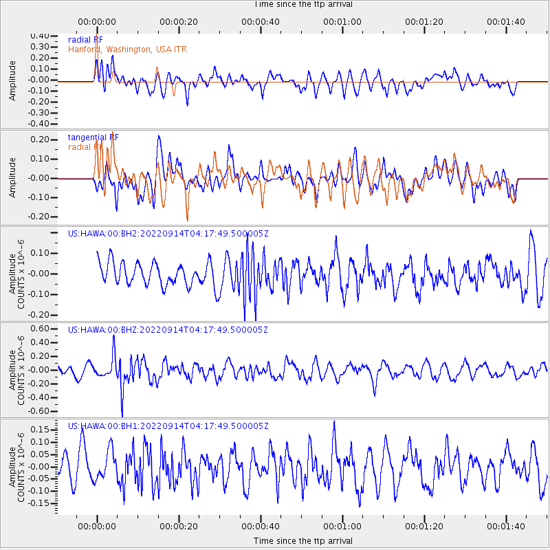
Signal To Noise
| Channel | StoN | STA | LTA |
| US:HAWA:00:BHZ:20220914T04:17:49.500005Z | 3.2500253 | 1.5715824E-7 | 4.8356007E-8 |
| US:HAWA:00:BH1:20220914T04:17:49.500005Z | 1.1515492 | 6.354533E-8 | 5.518247E-8 |
| US:HAWA:00:BH2:20220914T04:17:49.500005Z | 1.6462673 | 8.208614E-8 | 4.9861974E-8 |
| Arrivals |
| Ps | |
| PpPs | |
| PsPs/PpSs | |


