You are here: Home > Network List > TA - USArray Transportable Network (new EarthScope stations) Stations List
> Station H24A Dirks Ranch, Alva, WY, USA > Earthquake Result Viewer
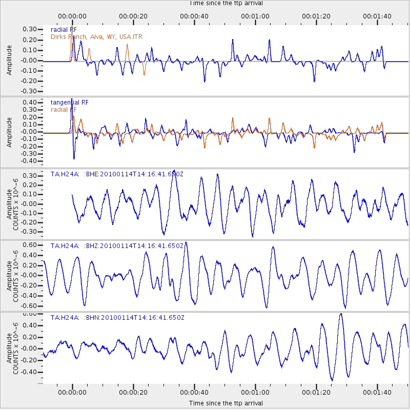
H24A Dirks Ranch, Alva, WY, USA - Earthquake Result Viewer
*The percent match for this event was below the threshold and hence no stack was calculated.
| Earthquake location: |
South Of Mariana Islands |
| Earthquake latitude/longitude: |
11.5/142.1 |
| Earthquake time(UTC): |
2010/01/14 (014) 14:03:41 GMT |
| Earthquake Depth: |
37 km |
| Earthquake Magnitude: |
5.7 MB, 5.8 MS, 5.8 MW, 5.7 MW |
| Earthquake Catalog/Contributor: |
WHDF/NEIC |
|
| Network: |
TA USArray Transportable Network (new EarthScope stations) |
| Station: |
H24A Dirks Ranch, Alva, WY, USA |
| Lat/Lon: |
44.75 N/104.55 W |
| Elevation: |
1166 m |
|
| Distance: |
97.9 deg |
| Az: |
41.334 deg |
| Baz: |
294.708 deg |
| Ray Param: |
$rayparam |
*The percent match for this event was below the threshold and hence was not used in the summary stack. |
|
| Radial Match: |
55.28698 % |
| Radial Bump: |
378 |
| Transverse Match: |
53.128845 % |
| Transverse Bump: |
400 |
| SOD ConfigId: |
1 |
| Insert Time: |
2010-03-17 23:04:06.964 +0000 |
| GWidth: |
2.5 |
| Max Bumps: |
400 |
| Tol: |
0.001 |
|
Signal To Noise
| Channel | StoN | STA | LTA |
| TA:H24A: :BHZ:20100114T14:16:41.650Z | 1.7985566 | 3.2441415E-7 | 1.8037473E-7 |
| TA:H24A: :BHN:20100114T14:16:41.650Z | 0.7575602 | 1.2610488E-7 | 1.6646186E-7 |
| TA:H24A: :BHE:20100114T14:16:41.650Z | 2.4635465 | 2.4315509E-7 | 9.870124E-8 |
| Arrivals |
| Ps | |
| PpPs | |
| PsPs/PpSs | |


