You are here: Home > Network List > US - United States National Seismic Network Stations List
> Station DGMT Dagmar, Montana, USA > Earthquake Result Viewer
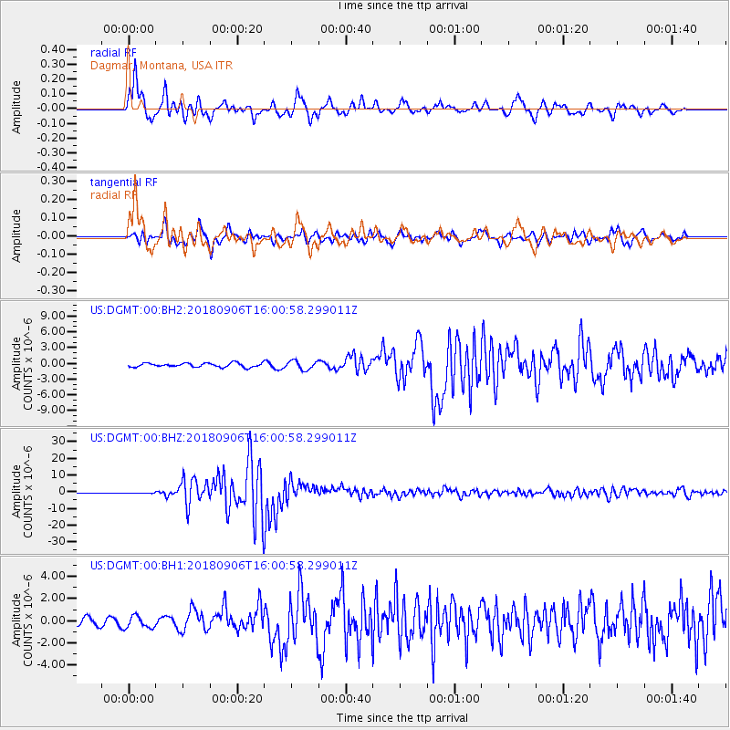
DGMT Dagmar, Montana, USA - Earthquake Result Viewer
*The percent match for this event was below the threshold and hence no stack was calculated.
| Earthquake location: |
Fiji Islands |
| Earthquake latitude/longitude: |
-18.4/179.5 |
| Earthquake time(UTC): |
2018/09/06 (249) 15:49:17 GMT |
| Earthquake Depth: |
669 km |
| Earthquake Magnitude: |
8.1 Mi |
| Earthquake Catalog/Contributor: |
NEIC PDE/at |
|
| Network: |
US United States National Seismic Network |
| Station: |
DGMT Dagmar, Montana, USA |
| Lat/Lon: |
48.47 N/104.20 W |
| Elevation: |
0.0 m |
|
| Distance: |
94.9 deg |
| Az: |
40.459 deg |
| Baz: |
247.794 deg |
| Ray Param: |
$rayparam |
*The percent match for this event was below the threshold and hence was not used in the summary stack. |
|
| Radial Match: |
96.33928 % |
| Radial Bump: |
400 |
| Transverse Match: |
87.76387 % |
| Transverse Bump: |
400 |
| SOD ConfigId: |
2825771 |
| Insert Time: |
2018-09-20 15:58:13.319 +0000 |
| GWidth: |
2.5 |
| Max Bumps: |
400 |
| Tol: |
0.001 |
|
Signal To Noise
| Channel | StoN | STA | LTA |
| US:DGMT:00:BHZ:20180906T16:00:58.299011Z | 2.3272665 | 3.3877112E-7 | 1.455661E-7 |
| US:DGMT:00:BH1:20180906T16:00:58.299011Z | 1.0270512 | 5.4655453E-7 | 5.32159E-7 |
| US:DGMT:00:BH2:20180906T16:00:58.299011Z | 2.3058612 | 8.4121865E-7 | 3.6481757E-7 |
| Arrivals |
| Ps | |
| PpPs | |
| PsPs/PpSs | |


