You are here: Home > Network List > G - GEOSCOPE Stations List
> Station PPTF Pamatai - Papeete - Tahiti island - French Polynesia, France > Earthquake Result Viewer
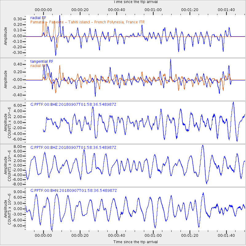
PPTF Pamatai - Papeete - Tahiti island - French Polynesia, France - Earthquake Result Viewer
*The percent match for this event was below the threshold and hence no stack was calculated.
| Earthquake location: |
Panama-Colombia Border Region |
| Earthquake latitude/longitude: |
8.0/-77.6 |
| Earthquake time(UTC): |
2018/09/07 (250) 01:47:23 GMT |
| Earthquake Depth: |
10 km |
| Earthquake Magnitude: |
5.6 mb |
| Earthquake Catalog/Contributor: |
NEIC PDE/us |
|
| Network: |
G GEOSCOPE |
| Station: |
PPTF Pamatai - Papeete - Tahiti island - French Polynesia, France |
| Lat/Lon: |
17.59 S/149.57 W |
| Elevation: |
705 m |
|
| Distance: |
75.5 deg |
| Az: |
249.533 deg |
| Baz: |
76.577 deg |
| Ray Param: |
$rayparam |
*The percent match for this event was below the threshold and hence was not used in the summary stack. |
|
| Radial Match: |
58.738945 % |
| Radial Bump: |
400 |
| Transverse Match: |
54.292576 % |
| Transverse Bump: |
400 |
| SOD ConfigId: |
2825771 |
| Insert Time: |
2018-09-21 02:01:14.039 +0000 |
| GWidth: |
2.5 |
| Max Bumps: |
400 |
| Tol: |
0.001 |
|
Signal To Noise
| Channel | StoN | STA | LTA |
| G:PPTF:00:BHZ:20180907T01:58:36.548987Z | 0.94139737 | 3.2672503E-6 | 3.470639E-6 |
| G:PPTF:00:BHN:20180907T01:58:36.548987Z | 2.065032 | 5.1772377E-6 | 2.507098E-6 |
| G:PPTF:00:BHE:20180907T01:58:36.548987Z | 1.5916889 | 2.521478E-6 | 1.5841525E-6 |
| Arrivals |
| Ps | |
| PpPs | |
| PsPs/PpSs | |


