You are here: Home > Network List > US - United States National Seismic Network Stations List
> Station DGMT Dagmar, Montana, USA > Earthquake Result Viewer
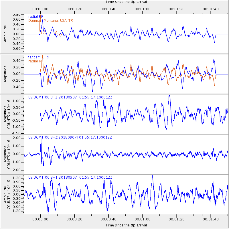
DGMT Dagmar, Montana, USA - Earthquake Result Viewer
*The percent match for this event was below the threshold and hence no stack was calculated.
| Earthquake location: |
Panama-Colombia Border Region |
| Earthquake latitude/longitude: |
8.0/-77.6 |
| Earthquake time(UTC): |
2018/09/07 (250) 01:47:23 GMT |
| Earthquake Depth: |
10 km |
| Earthquake Magnitude: |
5.6 mb |
| Earthquake Catalog/Contributor: |
NEIC PDE/us |
|
| Network: |
US United States National Seismic Network |
| Station: |
DGMT Dagmar, Montana, USA |
| Lat/Lon: |
48.47 N/104.20 W |
| Elevation: |
0.0 m |
|
| Distance: |
46.1 deg |
| Az: |
335.59 deg |
| Baz: |
142.052 deg |
| Ray Param: |
$rayparam |
*The percent match for this event was below the threshold and hence was not used in the summary stack. |
|
| Radial Match: |
51.70281 % |
| Radial Bump: |
400 |
| Transverse Match: |
67.93753 % |
| Transverse Bump: |
400 |
| SOD ConfigId: |
2825771 |
| Insert Time: |
2018-09-21 02:05:34.600 +0000 |
| GWidth: |
2.5 |
| Max Bumps: |
400 |
| Tol: |
0.001 |
|
Signal To Noise
| Channel | StoN | STA | LTA |
| US:DGMT:00:BHZ:20180907T01:55:17.100012Z | 3.8833425 | 7.094707E-7 | 1.826959E-7 |
| US:DGMT:00:BH1:20180907T01:55:17.100012Z | 1.9456806 | 5.410567E-7 | 2.7808093E-7 |
| US:DGMT:00:BH2:20180907T01:55:17.100012Z | 2.1324985 | 5.897843E-7 | 2.765696E-7 |
| Arrivals |
| Ps | |
| PpPs | |
| PsPs/PpSs | |


