You are here: Home > Network List > AK - Alaska Regional Network Stations List
> Station CUT Chulitna, AK, USA > Earthquake Result Viewer
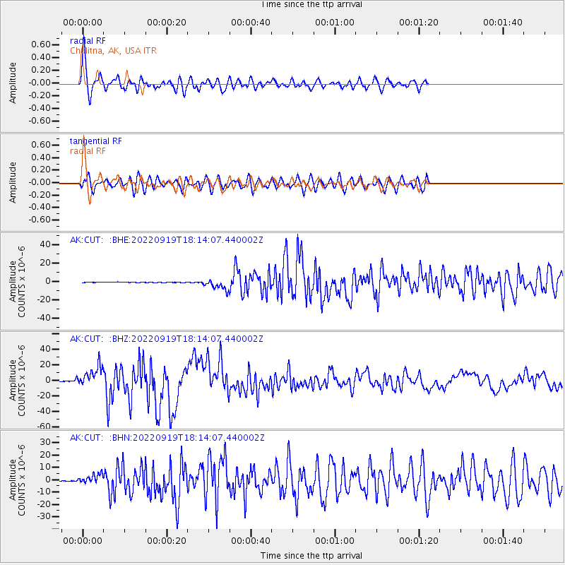
CUT Chulitna, AK, USA - Earthquake Result Viewer

| Earthquake location: |
Near Coast Of Michoacan, Mexico |
| Earthquake latitude/longitude: |
18.2/-103.4 |
| Earthquake time(UTC): |
2022/09/19 (262) 18:05:09 GMT |
| Earthquake Depth: |
10 km |
| Earthquake Magnitude: |
7.5 Mi |
| Earthquake Catalog/Contributor: |
NEIC PDE/at |
|
| Network: |
AK Alaska Regional Network |
| Station: |
CUT Chulitna, AK, USA |
| Lat/Lon: |
62.41 N/150.26 W |
| Elevation: |
574 m |
|
| Distance: |
54.7 deg |
| Az: |
335.407 deg |
| Baz: |
121.833 deg |
| Ray Param: |
0.06526505 |
| Estimated Moho Depth: |
34.75 km |
| Estimated Crust Vp/Vs: |
1.75 |
| Assumed Crust Vp: |
6.438 km/s |
| Estimated Crust Vs: |
3.679 km/s |
| Estimated Crust Poisson's Ratio: |
0.26 |
|
| Radial Match: |
86.97202 % |
| Radial Bump: |
400 |
| Transverse Match: |
67.356735 % |
| Transverse Bump: |
400 |
| SOD ConfigId: |
28764291 |
| Insert Time: |
2022-10-03 18:08:51.313 +0000 |
| GWidth: |
2.5 |
| Max Bumps: |
400 |
| Tol: |
0.001 |
|
Signal To Noise
| Channel | StoN | STA | LTA |
| AK:CUT: :BHZ:20220919T18:14:07.440002Z | 51.164783 | 1.3636985E-5 | 2.665307E-7 |
| AK:CUT: :BHN:20220919T18:14:07.440002Z | 14.628651 | 4.0468053E-6 | 2.7663557E-7 |
| AK:CUT: :BHE:20220919T18:14:07.440002Z | 23.301199 | 6.005619E-6 | 2.5773863E-7 |
| Arrivals |
| Ps | 4.3 SECOND |
| PpPs | 14 SECOND |
| PsPs/PpSs | 18 SECOND |


