You are here: Home > Network List > AV - Alaska Volcano Observatory Stations List
> Station AMKA Regional Station, Amchitka Island, Alaska > Earthquake Result Viewer
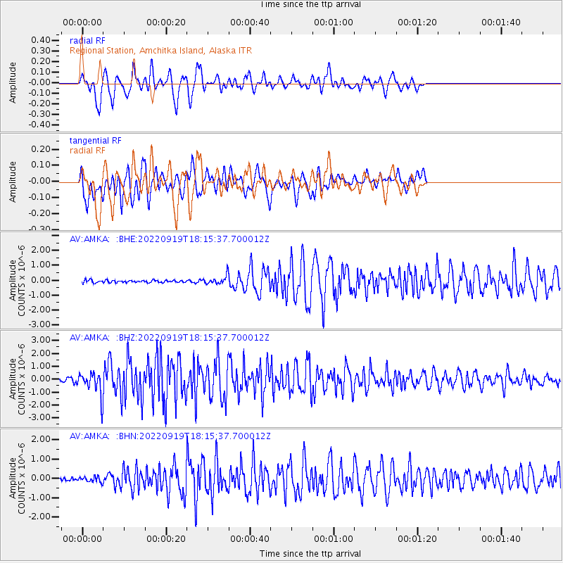
AMKA Regional Station, Amchitka Island, Alaska - Earthquake Result Viewer
*The percent match for this event was below the threshold and hence no stack was calculated.
| Earthquake location: |
Near Coast Of Michoacan, Mexico |
| Earthquake latitude/longitude: |
18.2/-103.4 |
| Earthquake time(UTC): |
2022/09/19 (262) 18:05:09 GMT |
| Earthquake Depth: |
10 km |
| Earthquake Magnitude: |
7.5 Mi |
| Earthquake Catalog/Contributor: |
NEIC PDE/at |
|
| Network: |
AV Alaska Volcano Observatory |
| Station: |
AMKA Regional Station, Amchitka Island, Alaska |
| Lat/Lon: |
51.38 N/179.30 E |
| Elevation: |
116 m |
|
| Distance: |
68.1 deg |
| Az: |
318.782 deg |
| Baz: |
88.042 deg |
| Ray Param: |
$rayparam |
*The percent match for this event was below the threshold and hence was not used in the summary stack. |
|
| Radial Match: |
64.73321 % |
| Radial Bump: |
400 |
| Transverse Match: |
70.75366 % |
| Transverse Bump: |
400 |
| SOD ConfigId: |
28764291 |
| Insert Time: |
2022-10-03 18:12:58.117 +0000 |
| GWidth: |
2.5 |
| Max Bumps: |
400 |
| Tol: |
0.001 |
|
Signal To Noise
| Channel | StoN | STA | LTA |
| AV:AMKA: :BHZ:20220919T18:15:37.700012Z | 11.609729 | 8.8437304E-7 | 7.617516E-8 |
| AV:AMKA: :BHN:20220919T18:15:37.700012Z | 1.4694827 | 1.3727372E-7 | 9.3416354E-8 |
| AV:AMKA: :BHE:20220919T18:15:37.700012Z | 3.6958787 | 2.9234866E-7 | 7.910126E-8 |
| Arrivals |
| Ps | |
| PpPs | |
| PsPs/PpSs | |


