You are here: Home > Network List > IU - Global Seismograph Network (GSN - IRIS/USGS) Stations List
> Station JOHN Johnston Island, USA > Earthquake Result Viewer
JOHN Johnston Island, USA - Earthquake Result Viewer

| Earthquake location: |
Near Coast Of Michoacan, Mexico |
| Earthquake latitude/longitude: |
18.2/-103.4 |
| Earthquake time(UTC): |
2022/09/19 (262) 18:05:09 GMT |
| Earthquake Depth: |
10 km |
| Earthquake Magnitude: |
7.5 Mi |
| Earthquake Catalog/Contributor: |
NEIC PDE/at |
|
| Network: |
IU Global Seismograph Network (GSN - IRIS/USGS) |
| Station: |
JOHN Johnston Island, USA |
| Lat/Lon: |
16.73 N/169.53 W |
| Elevation: |
2.0 m |
|
| Distance: |
62.8 deg |
| Az: |
279.818 deg |
| Baz: |
77.835 deg |
| Ray Param: |
0.060001515 |
| Estimated Moho Depth: |
44.75 km |
| Estimated Crust Vp/Vs: |
1.98 |
| Assumed Crust Vp: |
4.24 km/s |
| Estimated Crust Vs: |
2.141 km/s |
| Estimated Crust Poisson's Ratio: |
0.33 |
|
| Radial Match: |
85.28309 % |
| Radial Bump: |
361 |
| Transverse Match: |
83.65042 % |
| Transverse Bump: |
400 |
| SOD ConfigId: |
28764291 |
| Insert Time: |
2022-10-03 18:24:07.165 +0000 |
| GWidth: |
2.5 |
| Max Bumps: |
400 |
| Tol: |
0.001 |
|
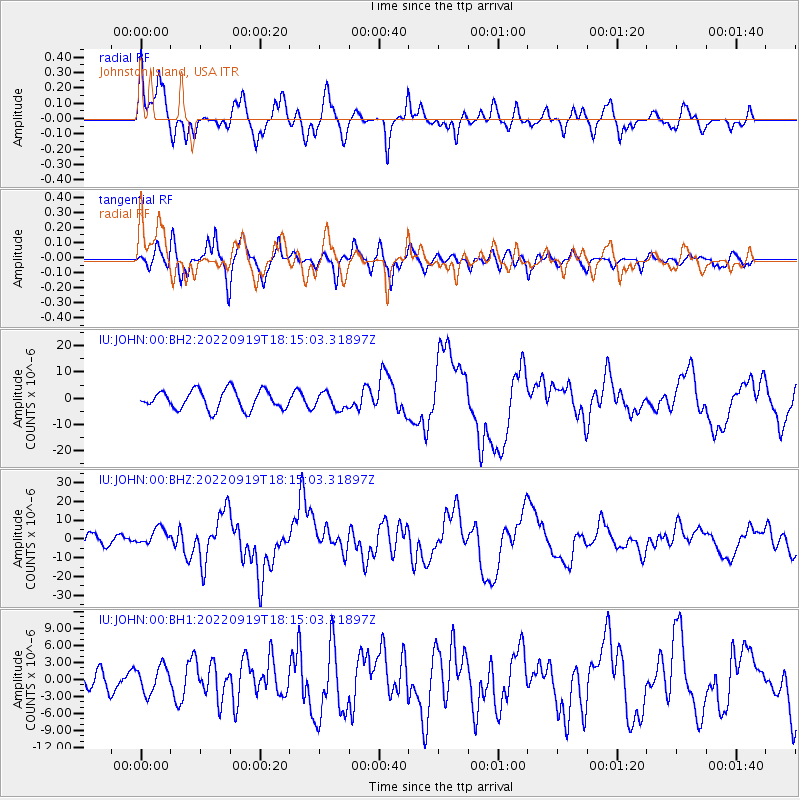
Signal To Noise
| Channel | StoN | STA | LTA |
| IU:JOHN:00:BHZ:20220919T18:15:03.31897Z | 1.8020738 | 4.4016847E-6 | 2.4425663E-6 |
| IU:JOHN:00:BH1:20220919T18:15:03.31897Z | 1.2879773 | 2.3000484E-6 | 1.7857833E-6 |
| IU:JOHN:00:BH2:20220919T18:15:03.31897Z | 0.86198103 | 3.1119882E-6 | 3.6102747E-6 |
| Arrivals |
| Ps | 11 SECOND |
| PpPs | 31 SECOND |
| PsPs/PpSs | 41 SECOND |


