You are here: Home > Network List > AV - Alaska Volcano Observatory Stations List
> Station AMKA Regional Station, Amchitka Island, Alaska > Earthquake Result Viewer
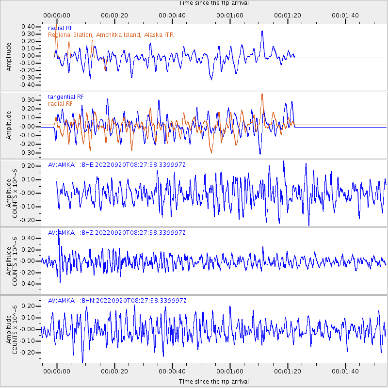
AMKA Regional Station, Amchitka Island, Alaska - Earthquake Result Viewer
*The percent match for this event was below the threshold and hence no stack was calculated.
| Earthquake location: |
Near Coast Of Michoacan, Mexico |
| Earthquake latitude/longitude: |
18.5/-103.5 |
| Earthquake time(UTC): |
2022/09/20 (263) 08:17:16 GMT |
| Earthquake Depth: |
54 km |
| Earthquake Magnitude: |
5.8 mww |
| Earthquake Catalog/Contributor: |
NEIC PDE/us |
|
| Network: |
AV Alaska Volcano Observatory |
| Station: |
AMKA Regional Station, Amchitka Island, Alaska |
| Lat/Lon: |
51.38 N/179.30 E |
| Elevation: |
116 m |
|
| Distance: |
67.8 deg |
| Az: |
318.707 deg |
| Baz: |
87.948 deg |
| Ray Param: |
$rayparam |
*The percent match for this event was below the threshold and hence was not used in the summary stack. |
|
| Radial Match: |
49.282265 % |
| Radial Bump: |
400 |
| Transverse Match: |
53.570877 % |
| Transverse Bump: |
400 |
| SOD ConfigId: |
28764291 |
| Insert Time: |
2022-10-04 08:24:23.110 +0000 |
| GWidth: |
2.5 |
| Max Bumps: |
400 |
| Tol: |
0.001 |
|
Signal To Noise
| Channel | StoN | STA | LTA |
| AV:AMKA: :BHZ:20220920T08:27:38.339997Z | 2.6151867 | 1.8431648E-7 | 7.047928E-8 |
| AV:AMKA: :BHN:20220920T08:27:38.339997Z | 1.0461732 | 6.515056E-8 | 6.227512E-8 |
| AV:AMKA: :BHE:20220920T08:27:38.339997Z | 0.8157465 | 4.836244E-8 | 5.9286116E-8 |
| Arrivals |
| Ps | |
| PpPs | |
| PsPs/PpSs | |


