You are here: Home > Network List > C8 - Canadian Seismic Research Network () Stations List
> Station GRIB Gribbell Island, BC, CA > Earthquake Result Viewer
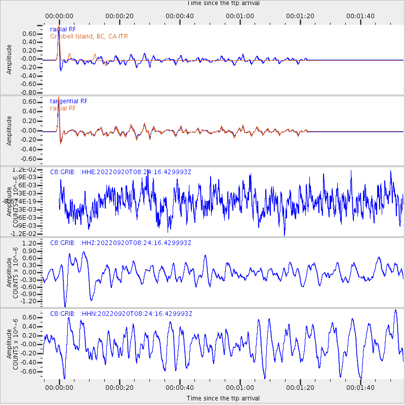
GRIB Gribbell Island, BC, CA - Earthquake Result Viewer
*The percent match for this event was below the threshold and hence no stack was calculated.
| Earthquake location: |
Near Coast Of Michoacan, Mexico |
| Earthquake latitude/longitude: |
18.5/-103.5 |
| Earthquake time(UTC): |
2022/09/20 (263) 08:17:16 GMT |
| Earthquake Depth: |
54 km |
| Earthquake Magnitude: |
5.8 mww |
| Earthquake Catalog/Contributor: |
NEIC PDE/us |
|
| Network: |
C8 Canadian Seismic Research Network () |
| Station: |
GRIB Gribbell Island, BC, CA |
| Lat/Lon: |
53.34 N/129.14 W |
| Elevation: |
418 m |
|
| Distance: |
40.1 deg |
| Az: |
336.255 deg |
| Baz: |
140.407 deg |
| Ray Param: |
$rayparam |
*The percent match for this event was below the threshold and hence was not used in the summary stack. |
|
| Radial Match: |
61.261894 % |
| Radial Bump: |
400 |
| Transverse Match: |
61.307564 % |
| Transverse Bump: |
400 |
| SOD ConfigId: |
28764291 |
| Insert Time: |
2022-10-04 08:26:45.813 +0000 |
| GWidth: |
2.5 |
| Max Bumps: |
400 |
| Tol: |
0.001 |
|
Signal To Noise
| Channel | StoN | STA | LTA |
| C8:GRIB: :HHZ:20220920T08:24:16.429993Z | 3.2586815 | 6.0213233E-7 | 1.847779E-7 |
| C8:GRIB: :HHN:20220920T08:24:16.429993Z | 1.193064 | 3.6994098E-7 | 3.100764E-7 |
| C8:GRIB: :HHE:20220920T08:24:16.429993Z | 1.3059542 | 5.0091145E-9 | 3.835597E-9 |
| Arrivals |
| Ps | |
| PpPs | |
| PsPs/PpSs | |


