You are here: Home > Network List > US - United States National Seismic Network Stations List
> Station WMOK Wichita Mountains, Oklahoma, USA > Earthquake Result Viewer
WMOK Wichita Mountains, Oklahoma, USA - Earthquake Result Viewer

| Earthquake location: |
Ecuador |
| Earthquake latitude/longitude: |
-2.3/-78.9 |
| Earthquake time(UTC): |
2018/09/07 (250) 02:12:04 GMT |
| Earthquake Depth: |
94 km |
| Earthquake Magnitude: |
6.2 Mww |
| Earthquake Catalog/Contributor: |
NEIC PDE/us |
|
| Network: |
US United States National Seismic Network |
| Station: |
WMOK Wichita Mountains, Oklahoma, USA |
| Lat/Lon: |
34.74 N/98.78 W |
| Elevation: |
486 m |
|
| Distance: |
41.3 deg |
| Az: |
334.909 deg |
| Baz: |
149.037 deg |
| Ray Param: |
0.07352575 |
| Estimated Moho Depth: |
32.0 km |
| Estimated Crust Vp/Vs: |
1.84 |
| Assumed Crust Vp: |
6.315 km/s |
| Estimated Crust Vs: |
3.432 km/s |
| Estimated Crust Poisson's Ratio: |
0.29 |
|
| Radial Match: |
94.90685 % |
| Radial Bump: |
400 |
| Transverse Match: |
91.97499 % |
| Transverse Bump: |
400 |
| SOD ConfigId: |
2825771 |
| Insert Time: |
2018-09-21 02:33:33.988 +0000 |
| GWidth: |
2.5 |
| Max Bumps: |
400 |
| Tol: |
0.001 |
|
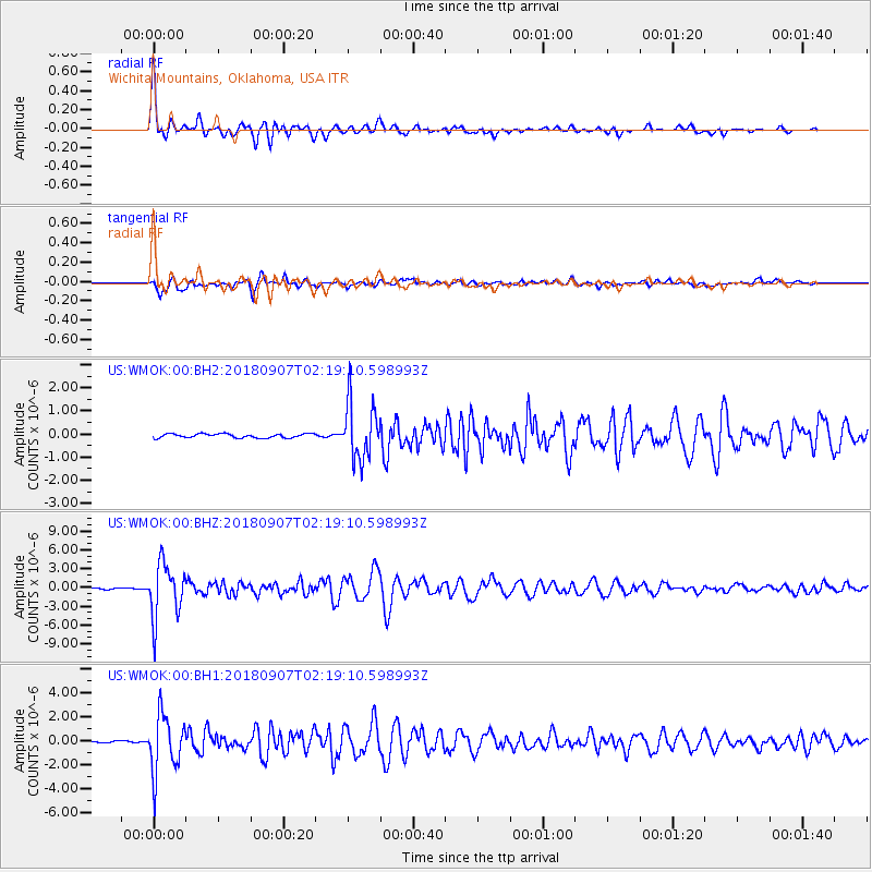
Signal To Noise
| Channel | StoN | STA | LTA |
| US:WMOK:00:BHZ:20180907T02:19:10.598993Z | 37.044395 | 4.343699E-6 | 1.1725656E-7 |
| US:WMOK:00:BH1:20180907T02:19:10.598993Z | 26.194187 | 2.3840653E-6 | 9.101505E-8 |
| US:WMOK:00:BH2:20180907T02:19:10.598993Z | 13.622109 | 1.215451E-6 | 8.922634E-8 |
| Arrivals |
| Ps | 4.5 SECOND |
| PpPs | 14 SECOND |
| PsPs/PpSs | 18 SECOND |


